Monterey Peninsula Real Estate Blog

Information about Monterey Peninsula Real Estate including new MLS Real Estate Listings by the Monterey Peninsula Home Team. You will see posts about Monterey Peninsula cities including Monterey, Pacific Grove, Pebble Beach, Carmel, Carmel Valley, Seaside, Marina and the HWY 68 Corridor.  These posts will have stories and information about local issues including real estate, news, and other helpful information, plus anything else we want to write about ;-).


April 22, 2026

Lovers Point Pacific Grove: History, Coastal Beauty & Early Social Life

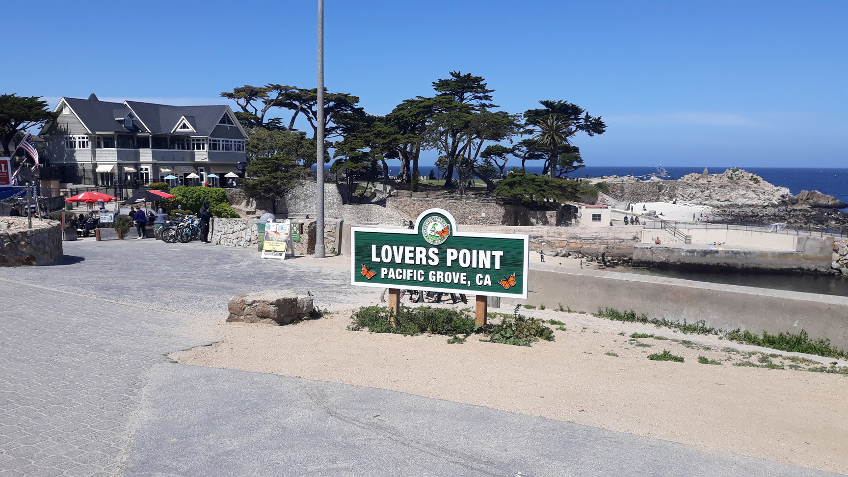
Lovers Point in Pacific Grove, CA

Lovers Point Pacific Grove: The Heart of Coastal Life and Community

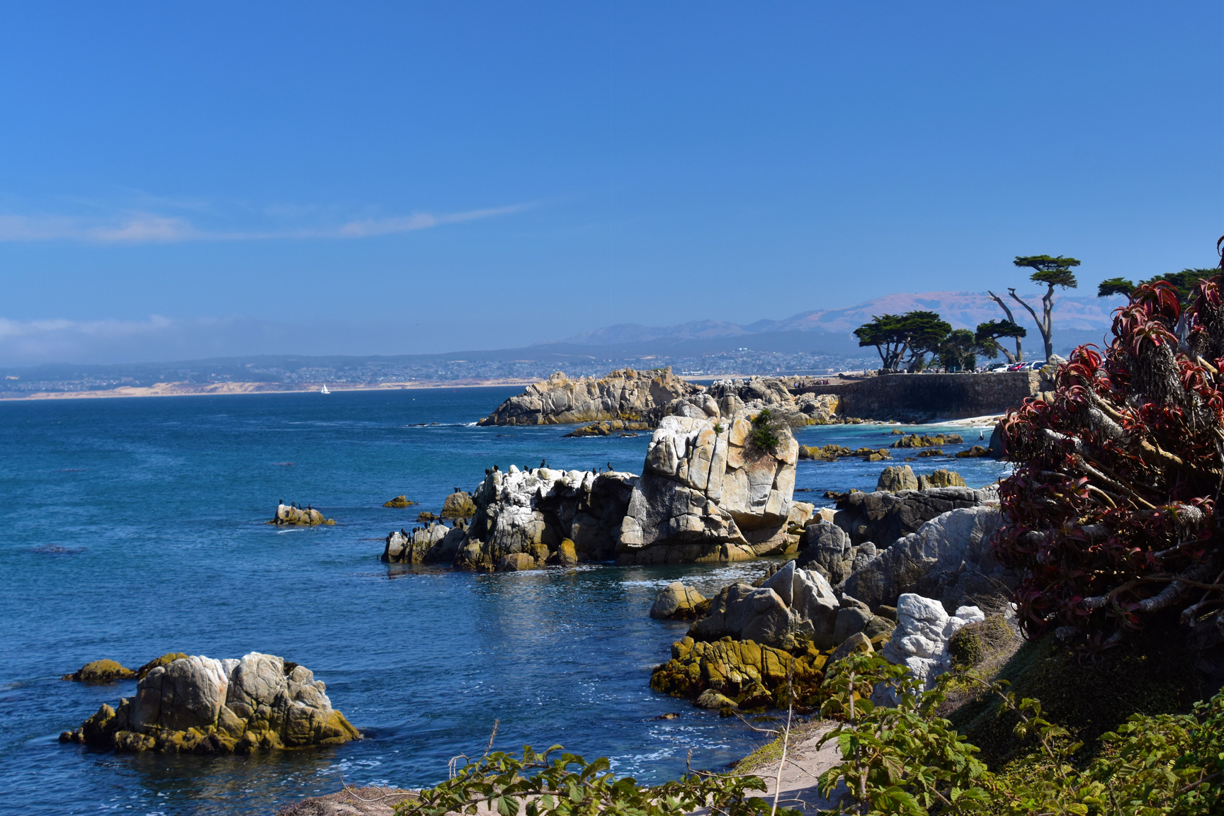
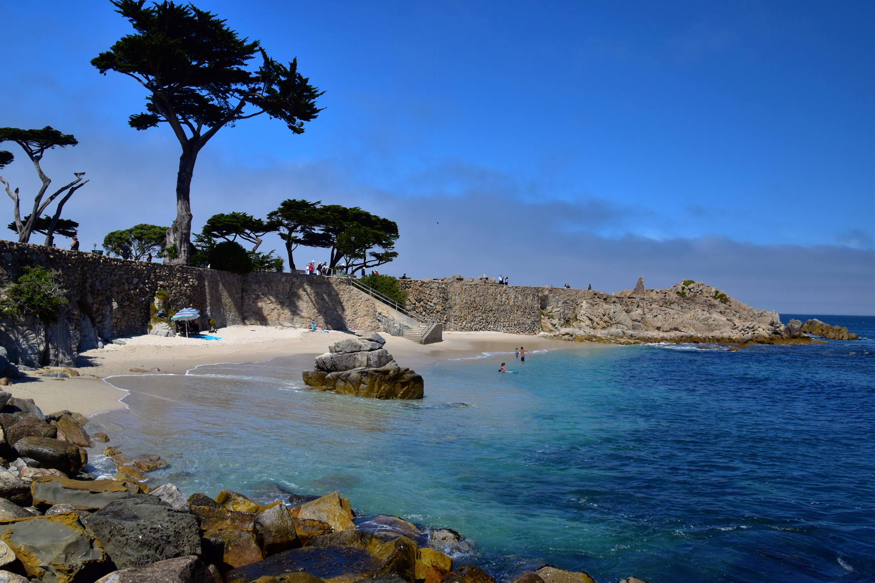
Few places capture the essence of Pacific Grove quite like Lovers Point. With its gentle cove, rocky shoreline, and sweeping views of the Monterey Bay, it is one of the most recognizable and beloved coastal destinations on the Monterey Peninsula.

But Lovers Point is more than just a scenic location—it has played a central role in shaping the social and cultural life of Pacific Grove since the town’s earliest days as a seaside retreat.

If you haven’t yet read how the town began, you can start here: How Pacific Grove Began: From Methodist Retreat to America’s Last Hometown.

An Early Gathering Place by the Sea

In the late 1800s, as Pacific Grove developed from its origins as a Methodist retreat, Lovers Point quickly became one of the community’s primary gathering places. Its protected cove made it ideal for swimming, picnicking, and socializing—activities that were central to the town’s early identity.

At a time when much of the Monterey Peninsula coastline was rugged and difficult to access, Lovers Point stood out as welcoming and usable. It provided residents and visitors alike with a rare opportunity to experience the ocean up close in a calm and approachable setting.

The Bathing Pavilion Era

By the early 20th century, Lovers Point had evolved into a more structured recreational destination. A bathing pavilion was constructed, offering changing facilities and formal access to the water—further cementing the area’s role as a hub of community life.

This period marked a shift from informal gatherings to a more organized coastal experience, drawing visitors from across the region. Swimming, boating, and seaside leisure became defining features of Pacific Grove’s social culture.

The legacy of this era is still visible today. While the original structures have changed over time, the spirit of accessible coastal recreation remains deeply embedded in the area.

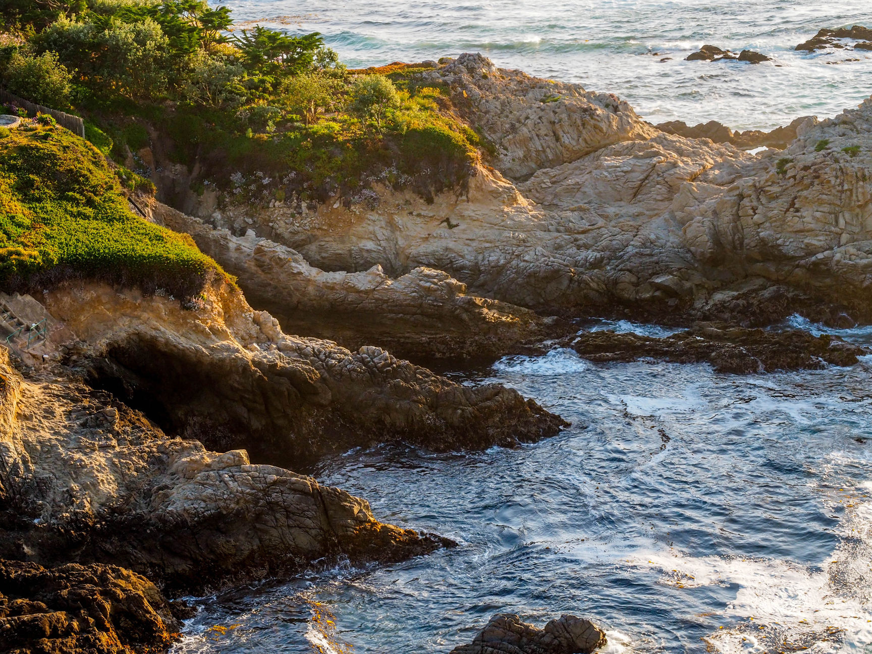
The beautiful Pacific Grove coastline near Lovers Point on the Monterey peninsula

A Front Row Seat to Monterey Bay

Lovers Point’s geography is part of what makes it so special. Facing directly into the Monterey Bay, it offers calm waters, sandy entry points, and panoramic ocean views—something that is surprisingly rare along this stretch of coastline.

Today, it is one of the best places on the peninsula to watch marine life. Sea otters, dolphins, and migrating whales are often visible just offshore, reinforcing Pacific Grove’s identity as a town closely connected to the natural environment.

This connection to the ocean continues to be a major driver of real estate demand. Homes within walking distance of Lovers Point are among the most sought-after in Pacific Grove, offering a lifestyle that blends coastal access with small-town charm.

From Social Hub to Iconic Landmark

Over time, Lovers Point transitioned from a simple gathering place into one of the most iconic landmarks on the Monterey Peninsula. It remains a focal point for community events, outdoor recreation, and daily life in Pacific Grove.

Residents walk the coastal trail, families gather in the park, and visitors return year after year to experience its unique setting. Despite its popularity, it has retained a sense of authenticity that reflects the town’s early values.

That continuity is one of the reasons Pacific Grove feels so different from other coastal markets. The places that mattered historically still matter today.

The Lifestyle Connection to Pacific Grove Real Estate

Lovers Point is not just a destination—it is a lifestyle anchor. Proximity to the coastline, walkability, and access to open space are all factors that continue to influence home values and buyer demand in Pacific Grove.

Unlike more resort-driven areas of the Monterey Peninsula, Pacific Grove offers a more grounded, community-oriented coastal experience. That distinction continues to attract buyers looking for authenticity, history, and long-term lifestyle value.

To explore available properties in this area, visit Pacific Grove homes for sale.

How Lovers Point Fits Into Pacific Grove’s Story

Lovers Point is one chapter in a much larger story—one that includes the town’s founding as a retreat, its Victorian architectural legacy, and its evolution into one of the Monterey Peninsula’s most desirable residential communities.

As you continue exploring Pacific Grove, you’ll see how these elements connect. Each plays a role in shaping the character of the town and the experience of living here.

Explore the Complete history of Pacific Grove, California—from its Indigenous roots and Methodist founding to its coastal lifestyle, historic homes, and modern real estate appeal.

For a broader perspective, visit our guide to living on the Monterey Peninsula.

Explore Pacific Grove Real Estate

April 21, 2026

How Pacific Grove Began: Methodist Retreat to America’s Last Hometown

Pacific Grove, CA America's last hometown

How Pacific Grove Began: From Methodist Retreat to America’s Last Hometown

Pacific Grove is one of the most distinctive communities on the Monterey Peninsula. Known today for its historic homes, dramatic coastline, walkable charm, and deep sense of community, the town began with a very different purpose: a vision for a peaceful Methodist seaside retreat.

That origin story still matters today. It explains why Pacific Grove feels different from neighboring communities, why so many of its older homes remain protected, and why the city continues to hold such lasting appeal for buyers looking for authentic coastal character.

If you are exploring Pacific Grove homes for sale or simply want to better understand the roots of this remarkable town, its founding story is the best place to begin.

A Coastal Vision Takes Shape

Pacific Grove’s beginnings trace back to 1874, when Reverend J.W. Ross, a Methodist minister, visited the forested coastline at the tip of the Monterey Peninsula. With its pine, oak, and cypress groves, mild climate, and sweeping views of the Pacific, the setting struck him as an ideal place for a religious retreat.

That idea soon became reality. In 1875, land was assembled for what became the Pacific Grove Retreat—a Christian seaside encampment intended to provide rest, spiritual reflection, education, and fellowship. In its earliest days, the retreat was made up largely of tent sites rather than permanent homes. Families would come to the coast, stay through the summer season, and gather for worship, lectures, and community life.

This was not simply a campground. It was the beginning of a carefully envisioned coastal community with a strong moral and social identity. In many ways, Pacific Grove was designed to feel orderly, thoughtful, and uplifting from the start—and that civic character still echoes through the town today.

From Tents to Cottages

As the retreat gained popularity, temporary accommodations gradually gave way to more permanent structures. Tents turned into wooden cottages, and the retreat grounds began evolving into a true town.

That transition is one of the reasons Pacific Grove has such a unique architectural feel today. Many of the homes and buildings that followed were modest in scale but rich in character, helping create the intimate streetscapes that continue to define the city. Over time, Pacific Grove developed a collection of Victorian-era and early 20th-century buildings that still give it an unmistakable sense of place.

For buyers who value classic coastal architecture, this legacy remains one of the city’s biggest draws. You can still see the influence of those early years in many of the cottages and historic neighborhoods that make Pacific Grove so visually memorable.

To browse some of the homes that best reflect this local character, you can also explore Pacific Grove cottages for sale.

A Community Built Around More Than Religion

Although Pacific Grove began as a Methodist retreat, it quickly developed a broader intellectual and cultural identity as well. By the late 19th century, the city became associated with Chautauqua-style gatherings that emphasized learning, lectures, science, and public enrichment.

That spirit helped shape institutions that still matter locally, including what became the Pacific Grove Museum of Natural History. The presence of educational and scientific programming set Pacific Grove apart from communities that grew purely from commerce or industry. The town developed as a place where nature, reflection, learning, and civic life were intertwined.

This blend of culture and coastal beauty still helps explain why Pacific Grove feels so layered. It is not just scenic. It is historically thoughtful, civically proud, and deeply tied to the idea that place should enrich daily life.

Incorporation and the Growth of a Real Town

As the retreat matured, Pacific Grove steadily transitioned from a seasonal destination into a permanent municipality. The city was incorporated on July 16, 1889, formalizing what had already become one of the Monterey Peninsula’s most distinctive communities.

What followed was a gradual evolution from retreat grounds to established residential town. Streets were named, homes multiplied, local institutions grew stronger, and Pacific Grove developed its own enduring identity—separate from Monterey, yet deeply connected to the broader history of the peninsula.

That identity remains one of Pacific Grove’s greatest strengths in today’s real estate market. Buyers are not just purchasing a home here; they are buying into a town with continuity, architectural authenticity, and a sense of heritage that cannot easily be replicated.

Why Pacific Grove Still Feels Different Today

Modern Pacific Grove is often called America’s Last Hometown, and that nickname fits because the city still feels intimate, human-scaled, and rooted in tradition. Historic homes, walkable streets, coastal trails, and neighborhood pride all reflect the town’s unusual beginning.

Unlike many coastal communities that developed primarily around resorts, large-scale commerce, or postwar expansion, Pacific Grove started with a more idealistic framework. That foundation helped create a town where preservation still matters and where the built environment often feels more personal than polished.

Today, Pacific Grove is also known for its preserved architecture, oceanfront beauty, and limited housing supply—factors that continue to support long-term demand. For many buyers, it offers a rare mix of history, lifestyle, and authenticity that is increasingly hard to find on the California coast.

If you want a broader look at the lifestyle that continues to attract buyers across the region, visit our guide to living on the Monterey Peninsula.

The Lasting Real Estate Appeal of Pacific Grove

Pacific Grove’s founding story is not just local history—it is part of the reason the town remains so desirable today. The same ingredients that made it appealing in the 1870s still resonate now: natural beauty, a calmer pace, distinctive homes, and a strong sense of place.

That is especially important in a market where true character is scarce. Pacific Grove offers buyers something more durable than trend-driven appeal. It offers continuity.

From its Methodist retreat origins to its present-day identity as one of the Monterey Peninsula’s most beloved residential communities, Pacific Grove has managed to preserve the qualities that made it special in the first place. That is a big reason why demand here remains strong—and why so many people fall in love with the town long before they ever make an offer on a home.

Explore the complete history of Pacific Grove, California—from its Indigenous roots and Methodist founding to its coastal lifestyle, historic homes, and modern real estate appeal.

Explore Pacific Grove Real Estate

If you are considering buying or selling in Pacific Grove, we would be happy to help you understand the neighborhoods, architecture, market trends, and lifestyle that define this special coastal town.

Start here:

April 17, 2026

From Industry to Destination: How Modern Monterey Reinvented Itself

Originally published April 17, 2026; substantially updated September 2026.
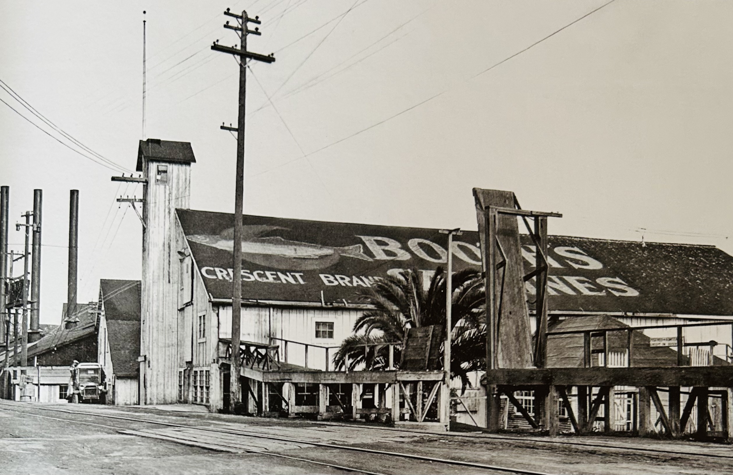
Booth's Cannery on Cannery Row

By the end of the 1940s, Monterey faced an economic crisis.

For decades, enormous schools of sardines had supported one of the busiest industrial fishing districts on the West Coast.

Fishing boats filled Monterey Bay. Canneries crowded Ocean View Avenue. Reduction plants operated around the clock. Thousands of people depended directly or indirectly on the industry.

Then the sardines largely disappeared.

Catches collapsed. Canneries closed. Industrial buildings stood vacant. The waterfront economy that had made Monterey famous appeared to be dying with the fishery.

Monterey could have become another former industrial town whose best years were behind it.

Instead, the city reinvented itself.

Over the next several decades, Monterey converted a declining industrial waterfront into a destination centered on history, recreation, dining, marine science and conservation.

An old railroad became a coastal recreation trail.

Former cannery buildings became restaurants, shops and hotels.

Fisherman's Wharf shifted from freight and commercial fishing toward dining, recreation and visitor excursions.

The former Hovden Cannery became the Monterey Bay Aquarium.

Historic adobes that might have disappeared during redevelopment became part of Monterey State Historic Park and the Path of History.

And in 1992, the ocean immediately offshore became part of one of America's great national marine sanctuaries.

The remarkable part is that Monterey did not create its new identity by completely erasing its old one.

It learned how to turn its history into part of its future.

Part of our Monterey History Series: This article begins where Monterey's great industrial era ends. Read The Sardine Boom and Cannery Row for the fishing and cannery story, or explore the complete chronology in our Complete History of Monterey, California.

The Sardine Economy Collapses

Monterey's industrial success had been extraordinary.

At the sardine industry's peak during World War II, approximately 16 canneries and 14 reduction plants operated around Ocean View Avenue.

But the industrial infrastructure depended on one critical resource:

enormous quantities of sardines.

During the late 1940s, catches fell dramatically as intense fishing pressure, changing ocean conditions and poor recruitment combined to reduce the fishery.

Monterey suddenly had factories designed to process huge catches without enough fish to keep them running.

Cannery Row Falls Quiet

One by one, plants reduced operations or closed.

Jobs disappeared.

Buildings deteriorated.

Fires removed portions of the industrial landscape.

Factories that had once been valuable because of their machinery and waterfront access became difficult obsolete properties.

The whistles that had summoned cannery workers when fishing boats returned increasingly fell silent.

Monterey had to answer a fundamental question:

What was an industrial waterfront worth when the industry was gone?

Steinbeck Had Already Given Cannery Row a Second Identity

Ironically, Cannery Row's industrial decline occurred just as the district's cultural fame was growing.

John Steinbeck published Cannery Row in 1945.

His fictional portrait of the waterfront and its unconventional inhabitants gave readers around the world an image of Monterey that had little to do with canned sardines as a commercial product.

Steinbeck transformed the Row from an industrial address into a literary place.

That distinction became increasingly valuable after the factories closed.

Ed Ricketts Leaves Another Legacy

Marine biologist Ed Ricketts also helped create a second way of understanding Monterey Bay.

While the canneries treated marine life primarily as a resource to harvest and process, Ricketts studied organisms in relation to their habitats and ecological communities.

His work at Pacific Biological Laboratories and in Between Pacific Tides helped establish an ecological perspective that would become increasingly relevant to Monterey's modern identity.

Read that story in Ed Ricketts, Pacific Biological Laboratories & the Real "Doc" of Cannery Row.

1958: Ocean View Avenue Becomes Cannery Row

The literary identity eventually overtook the original street name.

In 1958, Monterey officially renamed Ocean View Avenue Cannery Row.

The timing is significant.

The city adopted the name of its industrial past at almost exactly the moment the original industrial economy was disappearing.

That decision preserved an identity that might otherwise have vanished along with the factories.
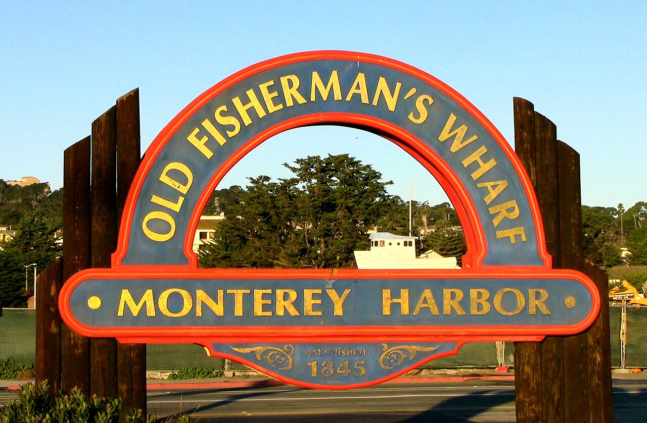
 

Fisherman's Wharf Monterey Harbor signTheConduqtor, CC BY-SA 3.0, via Wikimedia Commons

Fisherman's Wharf Reinvents Itself First

Another section of Monterey's waterfront had already begun adapting.

Old Fisherman's Wharf had spent generations serving shipping, freight and commercial fishing.

When the sardines disappeared after World War II, the Wharf increasingly shifted toward visitors.

By 1956, its businesses included restaurants, gift and candy shops, an aquarium, snack bars, boat rentals, fish markets and marine services.

The transformation was not absolute.

Commercial fishing remained part of Monterey Harbor, particularly around Municipal Wharf II.

But Old Fisherman's Wharf demonstrated an important idea:

a working waterfront could evolve toward recreation and tourism without completely losing its maritime identity.

1960: Monterey Builds a Modern Marina

The city's relationship with the harbor also changed as recreational boating became increasingly important.

Construction of the Monterey Municipal Marina began in 1959, and the facility was dedicated on September 11, 1960.

The original project provided 367 berths.

Instead of a waterfront dominated exclusively by commercial fishing and freight, Monterey Harbor increasingly accommodated sailboats, recreational craft, charter fishing and other marine activities.

A Cultural Reinvention Was Happening Too

Monterey's transformation was not limited to waterfront real estate.

The city increasingly became associated with major cultural events.

In 1958, the first Monterey Jazz Festival was held at the Monterey County Fairgrounds.

The festival became one of Monterey's enduring cultural institutions and helped establish the city as a destination for music as well as scenery and history.

1967: The Monterey International Pop Festival

Another extraordinary cultural moment arrived in June 1967.

The Monterey International Pop Festival brought some of the most important musicians of the era to the Monterey County Fairgrounds.

Performers associated with the festival included Jimi Hendrix, Janis Joplin, The Who, Otis Redding and others who would become central figures in rock history.

The festival helped launch the era of large modern rock festivals and gave Monterey another form of international recognition.

For a city still emerging from the collapse of its old industrial economy, this new cultural identity mattered.

Preservation Versus Redevelopment

Postwar Monterey was also confronting a problem shared by historic cities across the United States.

Older buildings occupied valuable land.

Automobiles required parking and wider transportation corridors.

Urban-renewal programs encouraged cities to replace aging structures with modern commercial development.

During the 1960s and 1970s, urban renewal substantially changed parts of Monterey.

Some historic buildings were lost.

Others were saved, moved or restored through the efforts of preservation organizations, California State Parks and the City.

Old Monterey Becomes an Asset Rather Than an Obstacle

The preservation movement gradually changed the way Monterey's oldest architecture was viewed.

Spanish, Mexican and early American buildings were not simply obsolete structures occupying downtown property.

They were physical evidence of Monterey's exceptional role in California history.

The Custom House, Larkin House, Pacific House and other historic buildings became part of Monterey State Historic Park.

In 1970, the Monterey Old Town Historic District was designated a National Historic Landmark.

The district contains an unusual collection of surviving adobe and early American buildings associated with Monterey's period as the Spanish and Mexican capital of California.

The Path of History Connects the City's Past

Rather than isolate Monterey's historic buildings inside a single fenced museum complex, the city's historic resources remain distributed throughout downtown and Old Monterey.

The Path of History connects many of them.

Visitors can walk between the Custom House, Pacific House, Colton Hall, Larkin House, historic adobes and other sites while moving through a functioning modern city.

This became an important part of Monterey's new destination identity.

History itself became something visitors could experience.

The surrounding residential area is explored in our Old Town Monterey Real Estate & Neighborhood Guide.

Cannery Row Begins Changing Hands

On Cannery Row, redevelopment followed a different path.

Beginning in the late 1950s and continuing through the 1960s and early 1970s, investors began acquiring former industrial properties.

Some old buildings were adapted for:

  • restaurants
  • specialty shops
  • visitor attractions
  • lodging
  • commercial uses

Not every cannery survived.

But increasingly, developers discovered that the industrial character itself had value.

A new building could be constructed almost anywhere.

An old Monterey cannery could exist only on Cannery Row.

Adaptive Reuse Becomes Part of Cannery Row's Identity

This realization helped create the Cannery Row visitors recognize today.

Former industrial structures could be repurposed rather than completely erased.

Old crossovers remained suspended over the street.

Cannery walls, boilers, foundations and warehouse forms survived inside or beside new commercial uses.

The Row's industrial architecture became part of its appeal.

Modern redevelopment therefore began using history as a design asset.
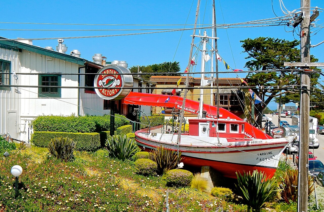
The Sardine Factory on Cannery Rowbahniuk, CC BY 3.0, via Wikimedia Commons

1968: The Sardine Factory Opens

One of the most important early milestones came on October 2, 1968.

Ted Balestreri and Bert Cutino opened The Sardine Factory restaurant.

At the time, Cannery Row was still widely viewed as a run-down former industrial district.

The restaurant began with only 72 seats.

Its success demonstrated that people would travel to Cannery Row for an upscale dining experience even though the surrounding district had not yet completed its transformation.

The Sardine Factory became one of the clearest early signals that Cannery Row's future might lie in hospitality rather than fish processing.

Tourism Was Not Completely New to Monterey

Monterey's shift toward a visitor economy after the sardine collapse was a reinvention—but it was also a return to an older idea.

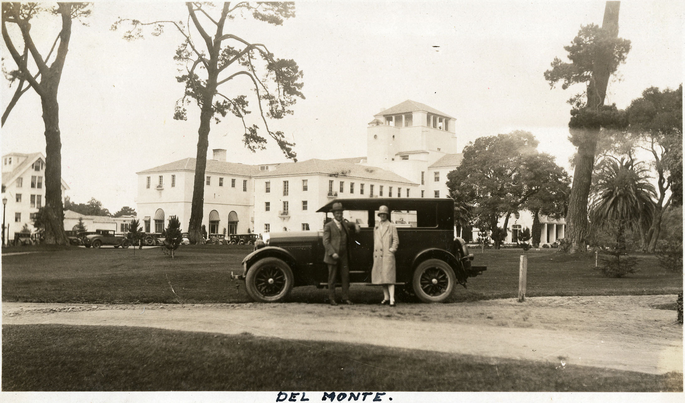
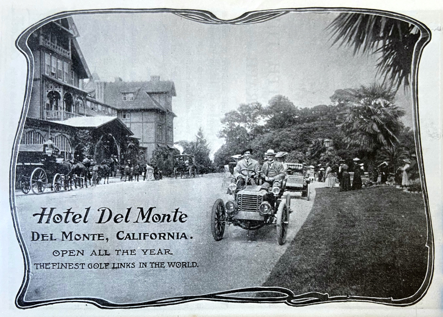
Hotel Del Monte had already demonstrated in 1880 that visitors would travel to Monterey for scenery, recreation and lifestyle.

The resort helped create 17-Mile Drive and Del Monte Golf Course and eventually influenced the development of Pebble Beach.

In that sense, postwar Monterey was not discovering tourism for the first time.

It was combining the old destination economy with an entirely new appreciation for industrial history, culture and the marine environment.

Explore the earlier resort era in Hotel Del Monte: Monterey's Resort, Golf & Military History.

The California Coast Becomes Something to Protect

While Monterey was reinventing its built waterfront, California's broader relationship with the coast was changing.

During the 1970s, environmental concerns and public demand for coastal access led to a new statewide planning framework.

The California Coastal Act of 1976 established policies addressing shoreline access, habitat, development and coastal resources.

For Monterey, that shift mattered enormously.

The waterfront was no longer evaluated only for its commercial development potential.

Public access, environmental quality and the long-term relationship between the city and Monterey Bay became increasingly important.

The Hovden Cannery Finally Closes

One major industrial operation survived long after the sardine collapse.

The Hovden Cannery, opened in 1916, continued processing other seafood after sardines were no longer dependable.

It eventually turned to products including squid.

But in 1973, Hovden finally closed.

The largest cannery on Cannery Row had become one of the last major links with the district's industrial past.

Its closure also created the site for Cannery Row's most important future institution.

A Different Idea for the Hovden Site

Stanford University's nearby Hopkins Marine Station already made the western end of Cannery Row an important center for marine research.

In the late 1970s, marine scientists associated with Stanford began imagining a public aquarium devoted specifically to the marine life of Monterey Bay.

Plans took shape beginning in 1977.

David and Lucile Packard provided the financial support that allowed the idea to grow into a major institution.

The chosen site was the former Hovden Cannery.

1984: The Monterey Bay Aquarium Opens

On October 20, 1984, the Monterey Bay Aquarium opened its doors.

The transformation was remarkable.

For generations, the Hovden property had been dedicated to processing marine life removed from Monterey Bay.

The new institution was devoted to helping people understand the living ecosystems within the bay.

The Aquarium did not hide the site's industrial past.

Elements of the former cannery were incorporated into the new building.

Once again, Monterey used adaptive reuse rather than complete erasure.

The Aquarium Changes More Than Cannery Row

The Aquarium quickly became far more than another visitor attraction.

It gave Monterey a new international identity centered on marine science and conservation.

Its exhibits emphasized the actual habitats immediately offshore, including kelp forests and Monterey Bay marine life.

Visitors increasingly came to Monterey not simply to look at the ocean but to understand what lived within it.

This represented a fundamental change from the industrial era.

From Extraction to Understanding

The symbolic progression is extraordinary:

Fishing grounds → canneries → marine laboratory → aquarium → conservation.

That progression does not mean commercial fishing vanished or that Monterey stopped benefiting economically from the ocean.

Fishing, recreation, hospitality, scientific research and marine-related businesses all remain part of the local economy.

What changed was the dominant public relationship with Monterey Bay.

The bay itself became something worth understanding and protecting.

1986: Railroad Tracks Become a Recreation Trail

Another industrial corridor was undergoing its own transformation.

The Southern Pacific railroad had once moved freight along Monterey's waterfront and served Cannery Row businesses.

After rail service declined and the corridor was abandoned, local agencies recognized that the right-of-way offered an unusual opportunity.

Beginning in 1986, the former railroad route was transformed into what became the Monterey Bay Coastal Recreation Trail.

Today the paved corridor extends for miles along the shoreline and connects Monterey with communities to the north and Pacific Grove to the west.

The Recreation Trail Changes How People Experience Monterey

The trail did more than replace railroad tracks with pavement.

It altered the relationship between neighborhoods and the waterfront.

People could walk or bicycle between:

  • Del Monte Beach
  • downtown Monterey
  • Fisherman's Wharf
  • Cannery Row
  • the Monterey Bay Aquarium
  • New Monterey
  • Pacific Grove

A transportation corridor once designed to move industrial goods became public recreational infrastructure.

Few changes better represent Monterey's economic evolution.

Del Monte Beach Reflects the Same Changing Philosophy

Monterey's changing relationship with the coastline was not confined to Cannery Row.

At Del Monte Beach, cottages and condominiums had been constructed among coastal dunes while other old subdivision lots remained undeveloped.

Later coastal planning increasingly emphasized dune habitat, public access and shoreline hazards.

Some land originally mapped for residential development was preserved and restored instead.

Read the full story in From Sand Dunes to Beach Neighborhood: The History of Del Monte Beach.

1992: Monterey Bay Becomes a National Marine Sanctuary

The evolution toward conservation reached another milestone on September 18, 1992.

NOAA designated the Monterey Bay National Marine Sanctuary.

The protected area today encompasses approximately 6,094 square miles of ocean and 276 miles of shoreline from the Marin coast south to Cambria.

Its habitats include:

  • kelp forests
  • rocky shores
  • sandy beaches
  • estuaries
  • open ocean
  • deep-sea habitat
  • Monterey Canyon
  • Davidson Seamount

The designation placed the waters immediately offshore within a national framework for conservation, research and sustainable use.

A Century-Long Reversal

Compare Monterey in approximately 1920 with Monterey at the end of the twentieth century.

In the industrial era, economic success meant catching more fish and processing them faster.

By the end of the century, some of Monterey's most important institutions were built around understanding, preserving and experiencing the marine environment.

The ocean had not become economically irrelevant.

Quite the opposite.

Its economic value increasingly depended on the fact that it remained alive, accessible and visually extraordinary.

Old Fisherman's Wharf Finds a New Role

Fisherman's Wharf continued evolving alongside Cannery Row.

Restaurants and shops expanded.

Charter fishing, sailing and whale-watching excursions became increasingly important.

Visitors could still watch commercial fishing activity and buy seafood, but the Wharf now functioned primarily as a place to experience Monterey Harbor rather than as a major freight terminal.

The physical infrastructure survived.

Its economic purpose changed.

Cannery Row Becomes a Conservation District

As redevelopment accelerated, Monterey also developed planning and design standards intended to retain important elements of Cannery Row's historic character.

That meant the district could change without being reconstructed as a generic modern waterfront.

Industrial forms, building scale, historic structures and visual remnants of the cannery era continued to inform new development.

This is why Cannery Row still looks recognizably industrial even though sardine processing disappeared generations ago.

A Waterfront Built From Layers

Modern Cannery Row therefore contains several historical periods simultaneously.

You can find:

  • remnants of nineteenth-century residential development
  • early fishing-community sites
  • cannery-era industrial structures
  • worker housing
  • Ed Ricketts' Pacific Biological Laboratories
  • mid-century restaurants
  • modern hotels
  • the Monterey Bay Aquarium
  • the former railroad corridor

That layering is precisely what distinguishes it from a purpose-built tourist development.

New Monterey Changes With Cannery Row

The transformation also affected New Monterey.

Homes built for fishermen and cannery workers increasingly became desirable because of their proximity to the waterfront, Aquarium, restaurants, recreation trail and Pacific Grove.

The relationship changed dramatically.

During the sardine era, living above Cannery Row meant being close to industrial employment.

Today it often means being close to one of Monterey's most recognizable lifestyle and visitor districts.

Historic Preservation Becomes Part of Monterey's Brand

Old Monterey and Cannery Row evolved differently, but the underlying lesson was similar.

Monterey increasingly discovered that old buildings could have economic value precisely because they were old.

Historic adobes differentiated downtown Monterey from newer California cities.

Cannery structures differentiated Cannery Row from ordinary shopping districts.

The waterfront's working history made it more interesting, not less.

Preservation therefore became intertwined with tourism and place-making.

Monterey Did Not Become a Resort Town in the Carmel Sense

There is an important distinction here.

Modern Monterey did not simply imitate Carmel-by-the-Sea or Pebble Beach.

Its identity remained more urban and institutional.

Monterey continued to include:

  • a working harbor
  • military institutions
  • government
  • marine research
  • historic neighborhoods
  • hotels and visitor businesses
  • commercial districts
  • residential communities

Tourism became enormously important, but it existed alongside other major institutions.

The Military Remained Part of Modern Monterey

Monterey's reinvention after the sardine collapse also occurred alongside a growing military-education presence.

The Defense Language Institute developed at the Presidio of Monterey after its predecessor moved to the city in 1946.

The Naval Postgraduate School moved to the former Hotel Del Monte property in 1951.

These institutions brought students, faculty, military families and international visitors to Monterey independently of tourism.

Explore those stories in The Presidio of Monterey: 250+ Years of Military History and Hotel Del Monte: Monterey's Resort, Golf & Military History.

A More Diverse Modern Economy Emerges

The old sardine economy was extraordinarily concentrated.

Fishing supplied the raw material.

Canneries processed it.

Reduction plants used the remaining fish.

A collapse in sardines therefore affected nearly the entire industrial chain.

Modern Monterey became more diversified.

Its economy increasingly drew from:

  • tourism and hospitality
  • military education
  • marine science
  • government
  • healthcare
  • recreation
  • restaurants and retail
  • events and conferences
  • residential and commercial real estate

That diversification was itself part of the city's reinvention.

Modern Monterey Is Still a City of the Bay

What did not change was Monterey's dependence on Monterey Bay.

The relationship simply evolved.

Spanish officials valued the protected harbor.

Mexican Monterey relied on maritime trade.

Chinese, Japanese, Sicilian and other fishing communities built commercial fisheries.

Canneries processed enormous quantities of sardines.

Marine scientists studied the shoreline.

Visitors came to see whales, sea otters and kelp forests.

The Aquarium interpreted the ecosystem.

The National Marine Sanctuary protected it.

Through every era, the bay remained central.

How Reinvention Changed Monterey Real Estate

The transformation of Monterey also changed the way residential locations were valued.

Neighborhoods once associated primarily with proximity to employment gained new advantages.

New Monterey became attractive for walking access to Cannery Row and Pacific Grove.

Old Town offered proximity to preserved historic architecture and downtown.

Del Monte Beach combined beach access with the recreation trail.

Areas above the city offered views across a waterfront increasingly valued for recreation rather than heavy industry.

Those changes helped create many of the location preferences that influence Monterey real estate today.

Cannery Row today

Tony Hisgett from Birmingham, UK, CC BY 2.0, via Wikimedia Commons

Cannery Row Today

Modern Cannery Row bears little economic resemblance to the industrial district Steinbeck knew.

Yet much of its appeal depends on the fact that the earlier place is still visible.

Old factory walls and crossovers remain.

Pacific Biological Laboratories survives.

The Aquarium incorporates the former Hovden site.

Industrial names and stories remain attached to modern properties.

For current residential information, visit our Cannery Row Real Estate & Homes for Sale guide.

The Reinvention Was Not a Single Project

It is tempting to credit Monterey's transformation entirely to the Aquarium.

The Aquarium was enormously important, but Monterey's reinvention had already been underway for decades.

Fisherman's Wharf began changing immediately after the sardine decline.

Historic preservation protected Old Monterey.

Restaurants and commercial operators invested in Cannery Row.

Cultural festivals brought international attention.

Coastal policy emphasized public access.

The Aquarium accelerated and elevated a transformation that many different people and institutions had already begun.

Monterey Reinvented Itself Without Erasing Itself

That may be the most important lesson of Monterey's modern history.

Many industrial districts are redeveloped by demolishing what existed and starting over.

Monterey did lose important historic buildings during its transition.

But enough remained that the city's earlier identities are still legible.

You can walk through Spanish and Mexican Monterey.

You can see the old Custom House.

You can follow the former railroad line.

You can stand beside an old cannery crossover.

You can visit Ed Ricketts' laboratory.

You can enter an Aquarium built on a former sardine cannery.

You can walk from Fisherman's Wharf to Cannery Row beside the same bay that created every previous version of Monterey.

The modern city grew from its past instead of replacing it entirely.

Frequently Asked Questions About Modern Monterey History

What happened to Monterey after the sardine industry collapsed?

Monterey gradually shifted away from a sardine-dependent industrial economy toward tourism, hospitality, recreation, historic preservation, military education, marine science and conservation. Cannery Row and Fisherman's Wharf were progressively adapted to new uses.

When was Ocean View Avenue renamed Cannery Row?

The City of Monterey officially renamed Ocean View Avenue Cannery Row in 1958, recognizing the name made internationally famous by John Steinbeck's 1945 novel.

When did Fisherman's Wharf become a tourist destination?

The transition began after the sardine fishery declined following World War II. By 1956, Fisherman's Wharf already included restaurants, gift shops, an aquarium, boat rentals, fish markets and other visitor-oriented businesses.

When did the Monterey Jazz Festival begin?

The Monterey Jazz Festival was founded in 1958 and became one of the city's most enduring cultural institutions. It continues to be held at the Monterey County Fairgrounds.

When was the Monterey Pop Festival?

The Monterey International Pop Festival was held at the Monterey County Fairgrounds in June 1967. It became one of the defining music festivals of the 1960s and helped establish the model for large modern rock festivals.

When did the Sardine Factory restaurant open?

Ted Balestreri and Bert Cutino opened The Sardine Factory on October 2, 1968. Its success became an important early milestone in Cannery Row's transition from declining industrial district to restaurant and visitor destination.

When did the Hovden Cannery close?

The Hovden Cannery continued processing other seafood after the sardine collapse but finally closed in 1973. The Monterey Bay Aquarium later opened on the former cannery property.

When did the Monterey Bay Aquarium open?

The Monterey Bay Aquarium opened on October 20, 1984 on the site of the former Hovden Cannery. It became a defining institution in Cannery Row's transformation and Monterey's modern marine-conservation identity.

When was the Monterey Bay Coastal Recreation Trail created?

Local agencies began transforming the abandoned Southern Pacific railroad right-of-way into the Monterey Bay Coastal Recreation Trail in 1986. The trail now connects communities along the Monterey Bay shoreline.

When was the Monterey Bay National Marine Sanctuary created?

NOAA designated Monterey Bay National Marine Sanctuary on September 18, 1992. The sanctuary now protects approximately 6,094 square miles of ocean along 276 miles of California coastline.

Is Cannery Row still an industrial district?

No. Modern Cannery Row is primarily a visitor-serving commercial, cultural and marine-science district. However, surviving cannery structures, industrial architecture and historic sites preserve important evidence of its earlier working-waterfront identity.

Why is Monterey's modern transformation historically important?

Monterey provides an unusually clear example of a city converting a declining resource-based industrial economy into one centered on historic preservation, recreation, marine science, conservation and tourism while retaining many physical reminders of the earlier waterfront.

Continue the Monterey History Series

This article completes the main chronological sequence of our Monterey History Series. Explore the earlier chapters:

  1. Monterey as the Capital of Alta California
  2. The Presidio of Monterey: 250+ Years of Military History
  3. Hotel Del Monte: Monterey's Resort, Golf & Military History
  4. The Sardine Boom and Cannery Row
  5. Ed Ricketts, Pacific Biological Laboratories & the Real "Doc" of Cannery Row
  6. Complete History of Monterey, California

Explore Modern Monterey Neighborhoods & Real Estate

Considering a home in Monterey or elsewhere on the Monterey Peninsula?
Call Mark Bruno and the Monterey Peninsula Home Team at (831) 917-8190.
Posted in Monterey History
April 17, 2026

The Sardine Boom and Cannery Row: How Monterey Built a Global Identity

Originally published April 17, 2026; substantially updated September 2026.

Cannery Row Booths broiled sardines label

Before Cannery Row became a destination of restaurants, hotels, shops and the Monterey Bay Aquarium, it was one of the hardest-working industrial waterfronts on the West Coast.

Fishing boats returned to Monterey Bay carrying tons of sardines.

Factory whistles summoned workers when the fleet came in.

Canneries operated late into the night processing fish while reduction plants converted enormous quantities of sardines and waste into fishmeal, oil and fertilizer.

At the industry's peak, Monterey became known as the "Sardine Capital of the World."

But Monterey's fishing history did not begin with sardines—or with the Italian fishermen most often associated with the later fleet.

The industry was built in layers by generations of Chinese, Japanese, Sicilian, Italian, Portuguese, Filipino, Mexican and other residents who brought different skills to Monterey Bay.

Technology changed the scale of the catch. Two world wars created enormous demand. Women made up an essential part of the cannery workforce. Industrial buildings crowded the shoreline. Residential neighborhoods grew uphill to house workers.

Then, almost as dramatically as the industry had risen, the sardines disappeared.

Canneries closed. Jobs vanished. Monterey's industrial waterfront fell into decline.

Yet the same era produced John Steinbeck's Cannery Row, Ed Ricketts' pioneering ecological work and the physical waterfront that Monterey would eventually reinvent as one of California's best-known destinations.

Part of our Monterey History Series: This article tells the industrial story of Monterey's fishing fleet and canneries. For Ed Ricketts, John Steinbeck and Pacific Biological Laboratories, read Ed Ricketts, Pacific Biological Laboratories & the Real "Doc" of Cannery Row. For the complete chronology, visit our Complete History of Monterey, California.

For current homes, condominiums and buyer information around the district, visit our Cannery Row Real Estate & Homes for Sale guide.

Monterey Was a Fishing Town Before It Was a Cannery Town

Monterey's relationship with Monterey Bay stretches back thousands of years.

Indigenous communities harvested marine resources long before European colonization.

After California entered the American era, commercial fishing expanded dramatically as immigrant communities established specialized fishing operations around the bay.

One of the most important early groups was the Chinese fishing community.

Chinese Fishermen Build an Early Commercial Industry

By the early 1850s, Chinese fishing families had established settlements around Monterey Bay.

One important community developed at Point Alones, near today's Hopkins Marine Station and Monterey Bay Aquarium.

Chinese fishermen harvested fish, squid and abalone and developed sophisticated drying and export businesses.

Their operations predated the famous sardine canneries by decades.

This history matters because Cannery Row did not suddenly appear when someone built a factory.

The industrial waterfront grew from an already-established maritime economy.

Japanese Fishermen Transform the Early Fleet

Japanese immigrants became increasingly important to Monterey fishing during the late nineteenth and early twentieth centuries.

They were particularly successful in salmon fishing.

City historical research records that in 1909, 145 of approximately 185 salmon boats fishing Monterey Bay were Japanese-owned.

That means Japanese fishermen controlled a substantial majority of Monterey's salmon fleet before sardines became the dominant catch.

Japanese entrepreneurship also played a direct role in the development of Cannery Row itself.

1902: The First Cannery on Ocean View Avenue

In 1902, Japanese businessman Otosaburo Noda and Harry Malpas founded the Monterey Fishing and Canning Company.

The plant packed salmon and abalone along Ocean View Avenue—the shoreline street that would later become Cannery Row.

City historical studies identify it as the first successful canning operation on the street that eventually became the center of Monterey's industrial fishing economy.

At that point, however, sardines were not yet the star of the industry.

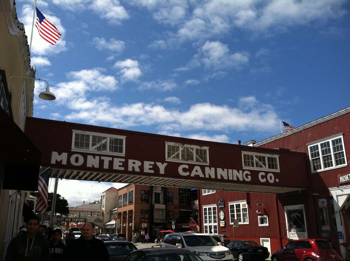
Cannery Row in Monterey

Frank Booth and the Monterey Packing Company

Another major figure was Frank E. Booth.

Booth had operated fish-processing businesses near Monterey's wharf before creating the Monterey Packing Company in 1903.

His operation helped introduce standardized one-pound oval cans that became closely associated with the sardine industry.

At first, salmon remained more commercially important.

Sardines were so abundant they could be treated almost as secondary fish.

That was about to change.

Knut Hovden Brings Engineering to the Cannery

In 1905, Booth hired Norwegian fisheries engineer Knut Hovden.

Hovden became one of the most important technological figures in Cannery Row history.

He helped mechanize the canning process through improvements involving:

  • automatic fish cutting
  • mechanized cooking
  • can soldering
  • conveyance and processing systems
  • greater production efficiency

Industrialization dramatically increased the amount of fish a cannery could process.

But factories could only process enormous quantities of sardines if fishermen could catch enormous quantities of sardines.

That problem was solved partly by another immigrant innovation.

Pietro Ferrante and the Lampara Net

Sicilian fisherman Pietro Ferrante introduced Monterey fishermen to the lampara net.

The net could surround an entire school of sardines rather than catching individual fish or small quantities.

Its use dramatically increased potential catches.

Instead of bringing back a few tons, fishing crews could land twenty or thirty tons of sardines at a time.

The fishing fleet and canneries now possessed technologies capable of operating on an industrial scale.

By the late 1910s, the lampara net had become a standard tool of the Monterey sardine fleet.

1908: Pacific Fish Company Expands Cannery Row

The enormous catches created by improved fishing methods quickly exceeded the capacity of Booth's original operation.

In 1908, the Pacific Fish Company was organized.

Its plant along Ocean View Avenue between Hoffman and McClellan became the first major cannery along the New Monterey shoreline.

By 1912, Booth's Monterey Packing Company and Pacific Fish Company were packing and shipping tens of thousands of cases of sardines.

Cannery Row was taking shape.

New Monterey Grows Above the Waterfront

The new industry needed workers—and those workers needed somewhere to live.

Residential development expanded uphill from the canneries into what became New Monterey.

Small cottages and modest homes provided housing relatively close to the waterfront.

This is why New Monterey's history cannot be separated from Cannery Row.

One was the workplace.

The other increasingly became home.

Why the Canneries Concentrated in New Monterey

Industrial development created a political problem for Monterey.

The city was already known as a resort destination because of Hotel Del Monte.

Smoke, industrial smells and factories were not exactly compatible with the luxury resort image.

By the late 1910s, Monterey zoning concentrated new industrial development in the lower portions of New Monterey along Ocean View Avenue.

This created a geographic compromise:

the fishing and canning industry could continue expanding while remaining separated from Hotel Del Monte and much of central Monterey.

World War I Creates the First Sardine Boom

World War I dramatically accelerated the industry.

Canned fish could be transported easily, stored for long periods and used as military provisions.

Demand soared.

Monterey's Cannery Row Cultural Resources Survey records the scale of the change:

sales increased from approximately 75,000 cans in 1915 to 1.4 million cans in 1918.

Five new canneries were constructed along Cannery Row between 1916 and 1918.

A local fishing business had become a wartime industrial complex.

1916: Knut Hovden Builds His Own Cannery

Hovden eventually separated from Booth and constructed his own operation.

On July 7, 1916, the Hovden Cannery opened near David Avenue and Ocean View Avenue.

The plant became one of Cannery Row's largest and most important canneries.

Decades later, that same site would become home to the Monterey Bay Aquarium.

That transformation—from major fish-processing plant to marine-conservation institution—is one of the most remarkable reversals in Monterey history.

The Reduction Plants Change the Economics

Canned sardines were only part of the industry's value.

Reduction plants converted fish and cannery waste into products such as:

  • fishmeal
  • fertilizer
  • fish oil
  • industrial by-products

By the early 1920s, large-scale reduction had become economically important.

This meant almost every part of the catch could generate revenue.

It also created an incentive to catch even greater quantities of sardines.

Cannery Row Was Loud, Crowded and Industrial

Modern Cannery Row is built around views of Monterey Bay.

Historic Cannery Row often blocked them.

Factories crowded the shoreline.

Elevated enclosed bridges crossed Ocean View Avenue, carrying fish, cans and materials between buildings on opposite sides of the street.

Railroad tracks ran through the district.

Boilers, machinery and reduction plants operated around the clock when the catch demanded it.

Smoke and steam rose above the waterfront.

It was not picturesque in the modern resort sense.

It was productive.

The Cannery Whistle Controlled the Workday

The fishing industry did not operate on an ordinary nine-to-five schedule.

Workers often did not know exactly when they would be needed.

When boats returned with sardines, cannery whistles summoned employees to work.

If the catch was enormous, processing could continue for hours.

The rhythm of the neighborhood followed the fishing fleet.

Women Were Essential to Cannery Row

The industrial history is sometimes told mainly through fishermen and cannery owners.

That leaves out a huge portion of the workforce.

Women performed much of the cannery processing work.

They cleaned, packed, trimmed and handled fish moving through the production lines.

Monterey's 2023 Path of History research specifically notes that women were predominantly employed in cannery work even when servicemen returned to the labor force after wartime service.

The sardine economy depended on labor both offshore and inside the factories.

A Multicultural Industrial Neighborhood

Cannery Row and New Monterey became extraordinarily diverse working communities.

People associated with the fishing and cannery economy included:

  • Chinese
  • Japanese
  • Sicilian and other Italian immigrants
  • Portuguese
  • Filipino workers
  • Mexican and Mexican American residents
  • other European and American workers

These communities did not all arrive at the same time or perform identical roles.

Their influence changed as immigration law, economics and discrimination altered who could work and settle in California.

Filipino Workers Become Part of Cannery Row

Filipino workers became increasingly visible in California labor during the 1920s and 1930s.

Some worked in Monterey canneries and lived in modest worker housing near the Row.

Reconstructed Cannery Worker Shacks at 799 Cannery Row commemorate the type of small dwellings occupied by Japanese fishermen and Filipino cannery workers during this period.

Those buildings remind visitors that today's expensive waterfront district once included extremely modest worker housing.

Ocean View Avenue Was More Than Factories

Although industry dominated the waterfront, Cannery Row was never exclusively industrial.

The surrounding district also included:

  • worker housing
  • boarding houses
  • markets
  • restaurants
  • bars
  • small businesses
  • entertainment

It was a complete working neighborhood built around the waterfront economy.

That human landscape would eventually become the raw material for John Steinbeck.

Ed Ricketts Works in the Middle of the Row

Marine biologist Ed Ricketts operated Pacific Biological Laboratories at what is now 800 Cannery Row.

His presence created an extraordinary contrast.

Outside his laboratory, businesses were extracting Monterey Bay's marine resources on a massive industrial scale.

Inside, Ricketts was studying the relationships among marine organisms and the environments in which they lived.

His 1939 book Between Pacific Tides, written with Jack Calvin, became an influential work in intertidal ecology.

Read his complete story in Ed Ricketts, Pacific Biological Laboratories & the Real "Doc" of Cannery Row.

The 1924 Cannery Row Fire

Industrial Monterey also carried significant fire risk.

On September 14, 1924, a major fire beginning at the Associated Oil Company destroyed several Cannery Row facilities and threatened a much larger portion of Monterey.

Fire would remain an ongoing danger in a district containing wooden industrial buildings, fuel, machinery and densely packed development.

The Purse Seine Changes Fishing Again

Fishing technology continued evolving.

The lampara net had revolutionized the early sardine fleet.

Larger purse seine nets eventually allowed fishermen to surround and capture even larger schools of sardines.

Boats became more powerful and efficient.

Catch capacity kept increasing.

The industrial system was becoming extraordinarily effective at removing sardines from Monterey Bay and the broader California Current.

The Great Depression Does Not End the Industry

The Depression affected seafood prices and national demand, but Monterey's sardine industry survived.

Reduction helped maintain profitability by creating additional products from fish.

The waterfront remained an important source of employment during economically difficult years.

Then another global war created an even greater demand for canned food.

World War II Brings Cannery Row to Its Peak

During World War II, Monterey's sardine industry reached extraordinary production levels.

The City of Monterey records that by the peak in 1945, approximately 16 canneries and 14 reduction plants surrounded Ocean View Avenue.

The city became widely known as the Sardine Capital of the World.

Factories operated at enormous scale.

But the prosperity concealed two profound problems.

One involved people.

The other involved fish.

1942: Japanese Americans Are Forced Out

Before World War II, Japanese Americans played a major role in Monterey's fishing industry.

City historical records indicate that Japanese Americans owned more than half of the fishing companies on Fisherman's Wharf before the war.

After the United States entered World War II, the federal government forcibly removed Japanese Americans from the West Coast.

Fishing boats were impounded and families were sent to incarceration camps.

City directories show the abrupt disappearance of Japanese families from the Cannery Row area after 1942.

This was not a natural change in the fishing economy.

It was the result of government policy based on wartime exclusion and racial discrimination.

Sicilian Fishermen Become Increasingly Dominant

With Japanese fishermen removed from the industry, Sicilian fishing families became even more prominent in Monterey's fleet.

Many of the family names associated with Monterey fishing for generations trace their roots to Sicilian immigrants who brought maritime traditions from the Mediterranean.

Their boats and crews became enduring symbols of Monterey's working harbor.

1945: Steinbeck Publishes Cannery Row

At almost exactly the moment when the sardine industry was reaching its peak, John Steinbeck published Cannery Row.

The 1945 novel transformed Monterey's industrial district into an international literary landscape.

Steinbeck did not write a documentary history.

He created a fictional community inspired by real people, businesses and places he knew.

Ed Ricketts became the primary model for Doc.

Pacific Biological Laboratories inspired Western Biological Laboratory.

The industrial waterfront became a human "tide pool."

Steinbeck gave the Row a cultural identity that would ultimately outlive the industry itself.

Then the Sardines Disappeared

The industry's collapse was astonishingly fast.

Monterey had built an industrial system capable of catching and processing sardines at tremendous scale.

But sardine populations were not unlimited.

A combination of factors contributed to the collapse, including:

  • intense fishing pressure
  • poor spawning years
  • changes in ocean conditions
  • shifts in the California Current ecosystem

The exact balance among those factors remains part of the scientific history of the fishery.

What is indisputable is what happened to Monterey.

The sardines virtually disappeared.

From Peak Production to Collapse

City historical research documents the speed of the decline.

The enormous wartime production levels could not be sustained.

By the late 1940s, catches had fallen catastrophically.

Canneries that depended on a constant supply of sardines suddenly had expensive industrial plants but too few fish to process.

One after another, businesses struggled, consolidated or closed.

The Cannery Whistles Fall Silent

The effect on Monterey went beyond factory owners.

Fishermen lost their primary catch.

Cannery workers lost shifts.

Businesses serving the industrial workforce lost customers.

Buildings stood vacant.

Reduction plants stopped operating.

The street that had been one of California's busiest fishing-industrial corridors became increasingly quiet.

Hovden Keeps Going

Some companies tried to survive by processing other seafood.

The Hovden Cannery continued operating after the sardine collapse and eventually processed products such as squid.

But even Hovden could not restore the old Cannery Row economy.

The plant finally closed in 1973.

It had survived longer than the other major sardine-era canneries, making its closure an important symbolic end to the industrial period.

1958: Fiction Renames the Real Street

The sardine industry was disappearing, but Steinbeck's Cannery Row was becoming increasingly famous.

In 1958, Monterey officially renamed Ocean View Avenue as Cannery Row.

This created one of the more unusual relationships between literature and geography.

Steinbeck had used a colloquial name for a real industrial district.

The fictional fame became so powerful that the city eventually adopted that name officially.

What Survived the Sardine Era?

Many industrial buildings disappeared after the collapse.

Others survived through adaptive reuse.

Remnants of former canneries, warehouses, crossovers, boilers, foundations and worker buildings remain embedded throughout Cannery Row.

The street therefore retains an industrial visual vocabulary even though its economic purpose has completely changed.

The Railroad Becomes a Recreation Trail

Freight rail once served Cannery Row's industrial businesses.

Tracks carried products and supplies along the waterfront corridor.

Much of that former rail alignment later became the Monterey Bay Coastal Recreation Trail.

Today people walk and bicycle through a corridor once dominated by freight movement and industrial production.

The physical transformation mirrors the economic one.

From Cannery Workers to Visitors

Beginning in the 1950s and accelerating during the following decades, Cannery Row gradually developed a new economy.

Restaurants, shops, hotels and attractions began replacing or reusing industrial properties.

The transition was not immediate.

For years, the Row contained vacant buildings, abandoned industrial remnants and uneven redevelopment.

But the direction was clear.

Monterey was turning an industrial waterfront into a visitor destination.

The next chapter is explored in From Industry to Destination: How Modern Monterey Reinvented Itself.

1984: The Hovden Cannery Becomes the Monterey Bay Aquarium

The ultimate symbol of Cannery Row's transformation came on October 20, 1984.

The Monterey Bay Aquarium opened on the former Hovden Cannery property.

Think about the reversal.

The Hovden Cannery had been created to process enormous quantities of marine life harvested from Monterey Bay.

The Aquarium was created to help visitors understand the marine ecosystems living in that same bay.

A center of extraction became a center of education and conservation.

Few redevelopment projects could symbolize Monterey's changing relationship with the ocean more clearly.

Cannery Row, Monterey, CA today

The Sardine Boom Still Shapes Monterey

The canneries are largely gone, but the industry remains embedded in Monterey.

It survives in:

  • Cannery Row's name
  • historic industrial buildings
  • Fisherman's Wharf
  • New Monterey cottages
  • Italian fishing families
  • Japanese and Chinese community history
  • Steinbeck's literature
  • Ed Ricketts' scientific legacy
  • the Monterey Bay Aquarium
  • the city's continuing identity as a place tied closely to Monterey Bay

The modern city cannot be understood without the industrial waterfront that preceded it.

New Monterey Is Part of Cannery Row History

Modern visitors often treat Cannery Row and New Monterey as completely separate places.

Historically, the relationship was much closer.

The canneries occupied the waterfront.

Workers, fishermen and their families lived uphill.

Businesses serving those residents developed along Lighthouse Avenue and adjoining streets.

To understand the residential side of this history, explore our New Monterey Real Estate & Neighborhood Guide.

Cannery Row Real Estate Today

Modern Cannery Row is primarily a historic commercial and visitor district rather than a conventional residential neighborhood.

Residential properties within or immediately adjacent to the actual Row are relatively limited.

Many homes marketed as being "near Cannery Row" are technically in adjoining New Monterey.

For modern housing, zoning, location and current MLS information, visit our Cannery Row Real Estate & Homes for Sale guide.

Why the Sardine Boom Belongs at the Center of Monterey History

Monterey has repeatedly reinvented itself.

It was the capital of Alta California.

Then it became a fishing and maritime town.

Hotel Del Monte helped turn the Peninsula into a resort destination.

The sardine industry then transformed Monterey into a global industrial center.

When the fishery collapsed, the city was forced to reinvent itself again.

Today's combination of historic preservation, tourism, marine science and recreation grew partly from the ruins of that industrial economy.

The sardine boom therefore was not simply one colorful period in Cannery Row history.

It was the bridge between old Monterey and modern Monterey.

Frequently Asked Questions About Monterey's Sardine Industry and Cannery Row

When did Monterey's sardine industry begin?

Commercial fishing in Monterey predates the sardine canneries by decades. Large-scale sardine processing developed during the early twentieth century as mechanized canning, improved fishing nets and new cannery operations allowed much larger catches to be processed.

Who started Cannery Row?

No single person created Cannery Row. Otosaburo Noda and Harry Malpas opened an important early cannery on Ocean View Avenue in 1902. Frank Booth expanded sardine canning, Knut Hovden introduced major mechanical innovations, and Sicilian fisherman Pietro Ferrante helped revolutionize catching through the lampara net.

Were Japanese fishermen important to Monterey's fishing industry?

Yes. Japanese fishermen played a major role in Monterey's early commercial fleet. City historic research records that in 1909, 145 of approximately 185 salmon boats fishing Monterey Bay were Japanese-owned. Japanese Americans remained important to the industry until their forced removal from the West Coast during World War II.

What did Sicilian fishermen contribute to Monterey fishing?

Sicilian fishermen brought extensive Mediterranean fishing experience to Monterey. Pietro Ferrante introduced the lampara net, which could surround entire schools of sardines and dramatically increased catch sizes. Sicilian fishing families subsequently became central to Monterey's fishing identity.

When did Knut Hovden open his cannery?

Knut Hovden opened his Cannery Row plant on July 7, 1916. It eventually became the largest sardine cannery on Cannery Row and continued operating until 1973. The Monterey Bay Aquarium later opened on the Hovden site.

Why did the sardine industry grow so rapidly during World War I?

Wartime demand for shelf-stable canned food increased dramatically. Monterey's Cannery Row survey records sales growing from approximately 75,000 cans in 1915 to 1.4 million cans in 1918, while five new canneries were constructed between 1916 and 1918.

How many canneries were on Cannery Row at its peak?

City historical research records approximately 16 canneries and 14 reduction plants around Ocean View Avenue at the industry's peak in 1945.

Why did Monterey's sardine industry collapse?

The collapse resulted from a combination of intense fishing pressure, weak spawning years and changing oceanographic conditions. Sardine populations fell dramatically during the late 1940s, leaving Monterey's large industrial processing infrastructure without enough fish to sustain it.

When was Ocean View Avenue renamed Cannery Row?

The City of Monterey officially renamed Ocean View Avenue Cannery Row in 1958 in recognition of the name made internationally famous by John Steinbeck's 1945 novel.

What happened to the Hovden Cannery?

Hovden continued processing other seafood after the sardine fishery collapsed but eventually closed in 1973. The Monterey Bay Aquarium opened on the former cannery site in 1984.

Did women work in Monterey's canneries?

Yes. Women formed an essential part of Cannery Row's industrial workforce and performed much of the fish cleaning, packing and processing work inside the canneries.

How is New Monterey connected with Cannery Row?

The waterfront canneries created substantial demand for nearby housing. New Monterey grew uphill from Cannery Row with cottages and homes occupied by fishermen, cannery workers and their families.

Continue the Monterey History Series

Explore Cannery Row and New Monterey Today

Considering a home in Monterey or elsewhere on the Monterey Peninsula?
Call Mark Bruno and the Monterey Peninsula Home Team at (831) 917-8190.
Posted in Monterey History
April 16, 2026

Monterey as the Capital of Alta California: History, Trade, and Early Influence

Originally published April 16, 2026; substantially updated September 2026.

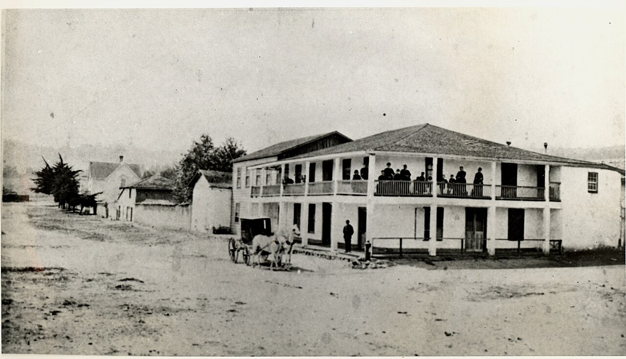
Early picture of Monterey, CA

Long before Monterey became known for Cannery Row, the Monterey Bay Aquarium and its dramatic coastline, it occupied a very different position in California.

Monterey was the political, military and commercial center of Alta California.

Under Spanish rule, governors administered an enormous frontier province from Monterey. Under Mexico, the city remained California's capital while its harbor became the territory's most important gateway for international trade.

Foreign merchants arrived by ship. Customs duties collected at Monterey helped finance the Mexican government. Diplomats and traders established themselves among Californio families. And within a remarkably small area around today's Old Monterey, decisions were being made that affected territory stretching hundreds of miles beyond Monterey Bay.

Then, in 1846, the American flag was raised at the Monterey Custom House and the city's role changed again.

Part of our Monterey History Series: This article focuses on Monterey's years as the capital of Spanish and Mexican Alta California. For the complete chronology, visit our Complete History of Monterey, California.

Many of the buildings and streets associated with this period survive within today's Old Town Monterey.

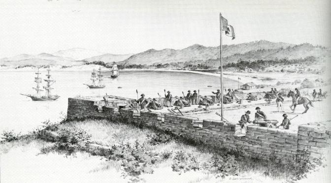
1770: Spain Establishes Monterey

Spain had claimed California generations earlier, but permanent European settlement at Monterey did not begin until 1770.

On June 3, Captain Gaspar de Portolá and Franciscan missionary Junípero Serra formally established the Royal Presidio of Monterey and Mission San Carlos Borromeo.

The mission soon moved south to the Carmel River, where it developed into today's Carmel Mission.

The Presidio remained in Monterey.

That military installation became the foundation for Monterey's political importance.

For the complete military story, see The Presidio of Monterey: History, Military Legacy and Lasting Impact.

Why Monterey?

Spain's interest in Monterey was strategic.

The protected bay provided an anchorage on a remote Pacific coastline, while the Presidio allowed Spain to reinforce its territorial claims at a time when other European powers were showing increasing interest in the North Pacific.

Monterey was isolated from the major centers of New Spain, but that isolation actually increased its administrative importance.

Someone had to govern the enormous northern territory.

Monterey became that place.

1774–1777: Monterey Becomes the Capital

The transition occurred in stages.

Monterey was designated the capital of Las Californias—Alta and Baja California—in the 1770s as Spanish administrators shifted the provincial seat northward.

On February 3, 1777, Monterey became the official capital of Alta California.

From this small settlement beside Monterey Bay, Spanish governors administered a territory extending far beyond the modern Monterey Peninsula.

The Royal Presidio served both military and governmental functions, while the settlement gradually expanded outside its walls.

What Did It Mean to Be the Capital of Alta California?

The word "capital" can create a misleading modern image.

Monterey was not filled with monumental government buildings or broad ceremonial avenues.

It remained a relatively small frontier settlement.

But politically, its importance was substantial.

The governor resided in Monterey. Military officers operated from the Presidio. Government correspondence flowed through the settlement. Ships brought officials, supplies and news from distant parts of the Spanish Empire.

The significance of Monterey came from the functions performed there—not from the size of the city.

The Spanish Capital Develops Beyond the Presidio

During Monterey's earliest years, much of the population lived within or immediately around the Presidio.

Gradually, civilian houses began appearing outside its walls.

Adobe became the characteristic building material.

Thick earthen walls moderated temperatures, while tile roofs and enclosed courtyards reflected building traditions adapted from Spanish and Mexican settlements elsewhere.

Many of the historic adobes that distinguish modern Old Monterey trace their origins to the political and commercial world that grew from the capital.

1818: The Capital Is Attacked

Monterey's isolation also made it vulnerable.

In 1818, Argentine revolutionary privateer Hipólito Bouchard attacked Monterey.

Spanish defenders withdrew, and Bouchard's forces briefly occupied the settlement and burned portions of it.

The episode was short-lived, but it demonstrated how difficult it was for Spain to defend its remote California capital.

1822: Monterey Becomes the Capital of Mexican California

Mexico won independence from Spain in 1821.

In 1822, Monterey formally transferred its allegiance to the new Mexican government.

Its political role continued.

For approximately the next quarter century, Monterey served as the political, social and economic capital of Mexican Alta California.

But Mexican rule changed Monterey in another important way.

California became increasingly open to international commerce.

Monterey Becomes an International Port

Spanish colonial policy had placed tight restrictions on foreign trade.

Independent Mexico relaxed those restrictions.

Ships from the United States, Britain and South America increasingly entered California waters looking to exchange manufactured goods for hides, tallow and other products from California's growing cattle economy.

Monterey's harbor became the principal gateway.

By 1831, Monterey had been designated California's official port of entry.

This made the capital not merely an administrative center but California's leading commercial marketplace.

The Hide and Tallow Economy

Cattle dominated much of Mexican California's economy.

Large ranchos produced hides and tallow that could be exchanged with visiting merchant ships.

Hides became so important that they were sometimes described as "California banknotes."

Ships brought manufactured goods that were difficult or impossible to produce locally.

Monterey therefore connected the ranchos of Alta California with an international maritime economy.

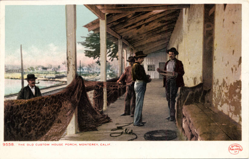
Monterey Custom House

The Monterey Custom House

The most important surviving symbol of this trade is the Monterey Custom House.

The Mexican government constructed the principal portion of the building in 1827.

Foreign merchants entering California were required to declare their cargo and pay customs duties.

Those duties mattered enormously because revenue from international trade helped support the Mexican government in California.

California State Parks identifies the Custom House as California's oldest surviving government building and California Historical Landmark No. 1.

A Capital Filled With Foreign Merchants

International trade brought outsiders into what had previously been a more isolated Spanish colonial community.

British, Scottish and American merchants settled in Monterey.

Some married into prominent Californio families and became influential figures in business and politics.

This produced a society that was increasingly multicultural and internationally connected.

Monterey was geographically remote, but politically and commercially it was becoming one of the most cosmopolitan places in California.

Larkin House, the original Monterey Colonial style of architecture

Thomas Oliver Larkin

Among the most influential American residents was Thomas Oliver Larkin.

Larkin arrived in California in the early 1830s and became a successful Monterey merchant.

His 1835 home combined traditional adobe construction with architectural ideas imported from New England.

The resulting hybrid became associated with the distinctive Monterey Colonial style.

Larkin later became the only United States consul to Mexican California, serving from his Monterey home between 1844 and 1846.

His commercial and diplomatic roles placed him directly inside the political transition that was approaching.

Monterey Becomes a Center of Diplomacy

By the 1840s, Monterey contained more than provincial government offices and merchants.

Foreign governments had an interest in California's future.

The United States maintained its consular presence through Larkin, while France also established consular representation in Monterey.

The city had effectively become the diplomatic center of a Mexican territory increasingly coveted by foreign powers.

1842: The United States Accidentally Captures Monterey

One of the strangest episodes in Monterey history occurred four years before the real American takeover.

In 1842, U.S. Commodore Thomas ap Catesby Jones mistakenly believed that the United States and Mexico had gone to war.

He sailed into Monterey, landed troops and took possession of the capital for the United States.

Then he learned there was no war.

Jones lowered the American flag, restored Mexican authority and apologized.

The incident might seem almost comic in retrospect, but it revealed how seriously the United States was already considering California's strategic importance. Monterey's official historical timeline records the mistaken seizure and subsequent apology.

1846: This Time the War Was Real

Four years later, circumstances were very different.

The United States and Mexico were at war.

Commodore John Drake Sloat, commanding the U.S. Pacific Squadron, entered Monterey Bay.

On July 7, 1846, American sailors and Marines landed and marched to the Custom House.

Sloat's proclamation was read and the American flag was raised.

The event marked the U.S. military takeover of Monterey and became one of the defining moments in California history.

1846 Was the Military Takeover—1848 Was the Legal Cession

This distinction is worth making because the two events are frequently compressed into one.

The United States established military control at Monterey in 1846.

But the Mexican-American War continued.

Mexico formally ceded California and other northern territories to the United States through the Treaty of Guadalupe Hidalgo in 1848.

Monterey therefore witnessed the practical change of government before the international treaty formally transferred sovereignty.

Monterey Under American Military Rule

Monterey continued functioning as an important government center during the American military period.

The Presidio again became central to military administration.

Thomas Larkin's house was used as military headquarters by prominent American officers.

And in August 1846, Monterey became home to The Californian, the first newspaper published in California under American rule.

1849: Monterey Helps Create the State of California

Monterey's capital era was nearly over, but its political importance had one final extraordinary chapter.

In September 1849, 48 delegates gathered at Colton Hall in Monterey.

Over the following weeks, they drafted California's first state constitution.

That constitution established the governmental framework under which California entered the Union on September 9, 1850.

Monterey was no longer destined to remain California's capital.

But the political system of the new state had been shaped within the former capital.

Why Monterey Lost Its Capital Role

California changed extraordinarily quickly after the American takeover and the discovery of gold.

Population and economic power shifted north toward San Francisco and the mining regions.

The new state capital moved several times before becoming permanently established in Sacramento.

Monterey became a comparatively quiet coastal town.

Ironically, that economic slowdown helped preserve parts of its earlier built environment.

While rapidly growing California cities replaced older structures, many of Monterey's Spanish- and Mexican-era adobes survived.

Oldest known image of Colton Hall in Monterey, CA

The Capital Is Still Visible in Old Monterey

The strongest evidence of Monterey's former political importance is not hidden in an archive.

You can still walk through it.

The Custom House, Larkin House, Colton Hall, Royal Presidio Chapel, Pacific House and numerous historic adobes survive within or near today's Old Monterey.

California State Parks recognizes the Monterey Old Town Historic District as nationally significant for its role as the Spanish and Mexican capital of California.

That makes Old Town Monterey more than a neighborhood with historic architecture.

It occupies the actual landscape where early California government, international trade and diplomacy took place.

Why Monterey's Capital History Still Matters

Modern Monterey is known for entirely different reasons.

Cannery Row, marine science, tourism, military education and coastal recreation have all become part of its identity.

But those later chapters grew from a city that already possessed an unusual concentration of government, military and commercial infrastructure.

The capital period established Monterey as a place connected to the world beyond Monterey Bay.

That pattern continued through the Presidio, Hotel Del Monte, the fishing industry, Cannery Row and the modern institutions that followed.

To continue chronologically, read The Presidio of Monterey and Its Military Legacy, then The History of Hotel Del Monte and The Sardine Boom and Cannery Row.

Frequently Asked Questions About Monterey as the Capital of Alta California

When did Monterey become the capital of Alta California?

Monterey's capital role developed during the 1770s. It was named the capital of Las Californias in 1774 and became the official capital of Alta California in 1777.

Was Monterey the capital under both Spain and Mexico?

Yes. Monterey served as the seat of government during Spanish rule and retained its role as the political capital of Alta California after California came under Mexican authority in 1822.

Why was Monterey selected as the capital?

Its protected harbor and strategic location made Monterey valuable as both a military outpost and administrative center on Spain's remote northern Pacific frontier.

Why was the Monterey Custom House important?

The Custom House collected duties on foreign goods arriving in California. International trade became an important source of government revenue during Mexican rule, and Monterey served as California's principal port of entry.

When was the Monterey Custom House built?

California State Parks dates the principal Mexican government Custom House to 1827, although portions of the site's customs facilities have an earlier history. The building was later expanded and altered, particularly under Thomas Larkin.

What happened in Monterey in 1842?

U.S. Commodore Thomas ap Catesby Jones mistakenly believed war had begun with Mexico and briefly seized Monterey for the United States. After discovering that the countries were still at peace, he restored Mexican authority and apologized.

When did the United States take Monterey?

Commodore John D. Sloat raised the American flag at the Custom House on July 7, 1846 during the Mexican-American War, establishing U.S. military control at Monterey.

When did California officially become U.S. territory?

The United States took military control of Monterey in 1846, but Mexico formally ceded California to the United States through the Treaty of Guadalupe Hidalgo in 1848.

Was California's first constitution written in Monterey?

Yes. Delegates met at Colton Hall in Monterey from September through October 1849 and drafted the constitution under which California entered the United States in 1850.

Continue the Monterey History Series

Monterey's years as California's capital were only the beginning of the city's story.

Continue with our Presidio of Monterey history, explore the complete chronology in our Complete History of Monterey, California, or see how this early history survives in today's Old Town Monterey.

Considering a home in historic Monterey or elsewhere on the Monterey Peninsula?
Explore Monterey real estate and homes for sale or call Mark Bruno and the Monterey Peninsula Home Team at (831) 917-8190.

Posted in Monterey History
April 16, 2026

The Presidio of Monterey: 250+ Years of Military History

The early days of Monterey and the Presidio

Originally published April 2026; substantially updated September 2026.

Few military installations in the United States occupy a landscape with a history as long and layered as the Presidio of Monterey.

The story begins in 1770, when Spain established a fortified settlement beside Monterey Bay to protect its claim to Alta California.

It continues through Mexican rule, the American takeover of California, an early U.S. fort associated with officers who would later become famous Civil War generals, decades of abandonment, the return of the U.S. Army in 1902, Buffalo Soldiers, cavalry and infantry training, the creation of nearby Fort Ord, World War II and ultimately one of the world's best-known military language schools.

Today the Presidio remains an active U.S. Army installation and is home to the Defense Language Institute Foreign Language Center.

That makes Monterey unusual.

The city's military importance did not end with the Spanish Empire or the Mexican-American War. Instead, the role of the military changed repeatedly as Monterey itself changed.

Part of our Monterey History Series: The Presidio developed alongside Monterey's role as the capital of Alta California. For the broader chronology, visit our Complete History of Monterey, California and Monterey as the Capital of Alta California.

The Presidio also borders today's New Monterey and overlooks Old Town Monterey, making its history unusually visible within the modern city.

Presidio of Monterey in the Old Days

1770: Spain Establishes the Presidio of Monterey

Spain had claimed portions of the California coast long before it established permanent settlements there.

By the eighteenth century, however, Spanish officials became increasingly concerned that other European powers—particularly Russia—might expand southward along the Pacific Coast.

Spain responded by establishing a chain of missions and military presidios in Alta California.

In May 1770, an expedition led by Gaspar de Portolá reached Monterey Bay.

Portolá commanded the military component of the expedition, while Franciscan missionary Junípero Serra led its religious mission.

On June 3, 1770, the Spanish formally established the Presidio of Monterey and Mission San Carlos Borromeo.

The mission soon moved south toward the Carmel River and developed into today's Carmel Mission.

The military post remained in Monterey.

The Original Presidio Was Near Today's Downtown

The first Presidio did not occupy exactly the same area people associate with the modern Army installation.

The original Spanish compound consisted primarily of adobe buildings arranged around a central square near what is now the area between downtown Monterey and Lake El Estero.

It contained military quarters, storage areas, administrative spaces and the chapel serving soldiers and their families.

That settlement became one of the foundations around which early Monterey grew.

Monterey, California - Cathedral of San Carlos Borromeo (Royal Presidio Chapel)

MARELBU, CC BY 3.0, via Wikimedia Commons

The Royal Presidio Chapel

One of the most important surviving links with the original Spanish Presidio is the Royal Presidio Chapel.

Today's stone church, known as the Cathedral of San Carlos Borromeo, replaced earlier structures associated with the original Presidio community.

The chapel remains one of the oldest continuously functioning religious sites associated with Spanish California and provides a rare physical connection with Monterey's earliest colonial settlement.

1792: El Castillo Guards Monterey Bay

The Spanish recognized that a presidio in the settlement itself was not sufficient to defend Monterey's harbor.

In 1792, Spain constructed a separate artillery fortification on the hill overlooking the bay.

The battery became known as El Castillo.

According to the U.S. Army's history of the Presidio, the fort contained 11 cannons.

Its commanding position gave artillery crews a broad view across Monterey Bay and the harbor below.

The site of El Castillo is particularly important because it provides the geographic connection between the Spanish defensive system and the later American military installation.

Monterey Becomes the Capital of Alta California

The Presidio's importance extended beyond military defense.

Monterey became the political capital of Alta California during the Spanish era.

The military post and capital city therefore developed together.

Governors, soldiers, government officials and civilians formed a small but strategically important settlement on the edge of the Spanish Empire.

Read the larger political story in Monterey as the Capital of Alta California.

1822: Mexican Rule Changes the Presidio

Mexico gained independence from Spain in 1821, and Monterey formally came under Mexican authority the following year.

The Presidio remained part of Monterey's military landscape, but the old Spanish installation gradually declined.

Mexico faced limited financial resources and enormous distances between California and the central government.

The original Presidio deteriorated, while Monterey increasingly became known for government, ranching and international maritime trade rather than as a heavily fortified military post.

The Hill Above Monterey Remained Strategically Important

Although the original Presidio deteriorated, the military value of the hill above the harbor did not disappear.

The same elevation that had attracted Spanish artillery planners offered commanding views of Monterey Bay to anyone responsible for defending the port.

That fact became important again in 1846.

1846: The United States Takes Monterey

During the Mexican-American War, Commodore John Drake Sloat sailed the U.S. Pacific Squadron into Monterey Bay.

On July 7, 1846, American sailors and Marines landed without significant resistance and raised the United States flag at the Monterey Custom House.

The United States had taken military control of Monterey.

Sloat left a small force behind to defend the town and harbor.

Rather than simply occupy the deteriorated Spanish compound, the Americans concentrated defensive work near the old El Castillo site on the hill.

Fort Mervine

The new American fortification became known as Fort Mervine, named for Navy Captain William Mervine, whose ship participated in Sloat's squadron.

Sailors and Marines initially improved the defenses.

In January 1847, Company F of the U.S. Army's 3rd Artillery Regiment arrived, and the Army assumed responsibility for construction.

Several young officers associated with the project later became nationally important military figures.

Sherman, Halleck and Ord in Monterey

The Monterey garrison included officers whose names would become much better known during the Civil War.

William Tecumseh Sherman served in California before becoming one of the Union's most famous generals.

Edward Otho Cresap Ord later became a senior Union Army commander.

Engineer Henry Wager Halleck also worked on the Monterey defenses and eventually served as General-in-Chief of the Union armies.

Their connection gives early American Monterey an unexpected link with the later history of the Civil War.

A Fort With Several Names

The early American defensive works acquired several names.

Historical records refer to:

  • Fort Mervine
  • Fort Halleck
  • Fort Savannah
  • the Monterey Redoubt

The changing terminology can make Monterey's military history confusing.

These names generally relate to evolving uses of the American fortifications on or near the former Spanish defensive site rather than to completely unrelated installations scattered around Monterey.

1852: The Monterey Ordnance Depot

In 1852, the Monterey Redoubt was redesignated the Monterey Ordnance Depot.

It served primarily as a military storehouse rather than a major active garrison.

By 1856, even that role had diminished.

The Presidio Was Not Continuously Occupied

This is an important correction to a common version of Monterey's military story.

The Presidio has an extraordinarily long military history, but the American installation was not continuously occupied throughout the nineteenth century.

The post was abandoned from 1856 until 1865.

It was briefly reoccupied during the closing months of the Civil War and then abandoned again in 1866.

The federal government nevertheless retained approximately 140 acres of the military reservation for possible future use.

That decision turned out to be consequential.

The Army Returns in 1902

More than three decades passed before Monterey again became home to a substantial active Army post.

Near the end of the Philippine-American War, the U.S. Army was looking for additional military installations on the West Coast.

Army planners recognized that the federal government already owned the old military reservation above Monterey.

In July 1902, the Army announced plans to establish a permanent cantonment there.

The 15th Infantry Builds the New Post

The 15th Infantry Regiment, which had served in China and the Philippines, arrived in Monterey in September 1902.

Its soldiers began constructing a new Army post around what is now Soldier Field.

The early construction included:

  • wooden barracks
  • officers' quarters
  • a hospital
  • a commissary
  • quartermaster facilities
  • support buildings

Many of the historic buildings associated with this period remain part of the Presidio's architectural landscape.

The Buffalo Soldiers Come to Monterey

Shortly after the 15th Infantry arrived, Monterey welcomed soldiers of the 1st Squadron, 9th Cavalry Regiment.

The 9th Cavalry was one of the African American Army regiments whose members became widely known as Buffalo Soldiers.

The soldiers established cavalry facilities at the new Monterey post and trained with horses on the Peninsula.

Their presence adds an important chapter to both Monterey and African American military history.

Army historical records preserve photographs of the 9th Cavalry encampment and its soldiers participating in activities around Monterey and Pacific Grove.

1903: Ord Barracks

The modern installation's name changed quickly.

The Army initially referred to the site as the Monterey Military Reservation.

On July 13, 1903, it became Ord Barracks, honoring Edward O.C. Ord, the officer who had served at Monterey decades earlier and later became a Civil War general.

That name lasted only about a year.

1904: The Presidio of Monterey Returns

On August 30, 1904, the War Department renamed the installation the Presidio of Monterey.

The name deliberately honored the Spanish military post established 134 years earlier.

This is the origin of the name used by today's U.S. Army installation.

The Army School of Musketry

Monterey soon became involved in military education as well as troop housing and training.

From 1907 to 1913, the Army School of Musketry operated at the Presidio.

The Army identifies it as a predecessor of the modern Infantry School.

That educational role foreshadowed the specialized training mission that would eventually define the Presidio after World War II.

Monterey Needs More Training Land

The Presidio itself was not large enough for all of the training required by a modern Army.

In 1917, the War Department purchased approximately 15,609 acres of nearby land known as the Gigling Reservation.

The new training area gave Presidio troops room for field exercises beyond the relatively compact Monterey installation.

This land would eventually become the foundation of another military post whose name became synonymous with the Monterey Peninsula.

The Creation of Fort Ord

The Gigling Reservation expanded over time.

On August 15, 1940, the larger training installation was officially named Fort Ord.

This created an important distinction.

The Presidio of Monterey and Fort Ord were separate military installations.

The Presidio remained on the hill immediately above Monterey.

Fort Ord occupied thousands of acres farther north and east between Monterey Bay and the Salinas Valley.

The two installations were closely connected, but they served different functions.

Cavalry at the Presidio

Cavalry remained an important part of Presidio life during the early twentieth century.

The 11th Cavalry Regiment was stationed at the Presidio from 1919 until 1940.

Artillery units also served there.

Stables, riding areas and other cavalry-related structures once occupied substantial portions of the military landscape.

The Lower Presidio Historic Park still contains physical traces and interpretive sites associated with this period.

The Great Depression and Civilian Conservation Corps

During the Depression, Army personnel from the Presidio also helped administer and support Civilian Conservation Corps activities.

Presidio soldiers participated in organizing CCC camps as well as Citizens' Military Training Corps and ROTC programs.

This expanded the post's influence beyond the boundaries of the installation itself.

World War II Changes Monterey's Military Landscape

World War II dramatically increased military activity throughout the Monterey Peninsula.

Fort Ord expanded into one of the largest Army training installations on the West Coast.

The Presidio itself became the temporary headquarters of III Corps in 1940 and later served as a military reception center.

By late 1944, the post was briefly declared inactive.

But its next mission was already approaching.

Preparing for the Occupation of Japan

The Presidio reopened in 1945 as a Civil Affairs Staging and Holding Area.

Personnel preparing for civil-affairs responsibilities connected with the occupation of Japan passed through Monterey.

This role created a logical connection with a specialized Army school that was about to need a permanent home.

The Language School Did Not Begin in Monterey

Today's Defense Language Institute is so closely associated with Monterey that it is easy to assume the school originated at the Presidio.

It did not.

Its roots go back to November 1941, shortly before the United States entered World War II.

The Army established a small secret Japanese-language school at the Presidio of San Francisco.

The first class consisted of four instructors and approximately 60 students, most of whom were second-generation Japanese Americans, or Nisei.

The Nisei Linguists

The history of these first military linguists is one of the most important chapters in the Defense Language Institute story.

Following the attack on Pearl Harbor and the forced removal of Japanese Americans from the West Coast, the school could no longer remain in California.

It moved first to Camp Savage, Minnesota, in 1942 and then to nearby Fort Snelling in 1944.

Thousands of graduates served as linguists, interpreters and intelligence specialists in the Pacific Theater and during the subsequent occupation of Japan.

Many served the United States while their own families were subjected to wartime incarceration.

Their contribution remains central to the institutional history of today's Defense Language Institute.

1946: The Language School Comes to Monterey

After World War II, the military's need for trained linguists did not disappear.

In 1946, the Military Intelligence Service Language School moved from Fort Snelling to the Presidio of Monterey.

The move permanently transformed the purpose of the installation.

A post historically associated with infantry, cavalry and artillery increasingly became a center for language, intelligence and education.

1947: The Army Language School

In 1947, the school became the Army Language School.

The curriculum expanded rapidly beyond Japanese.

Languages taught during the early Cold War included Russian, Chinese, Korean, Arabic and numerous European and Asian languages.

Native-speaking instructors were recruited from around the world.

This created an unusual cultural effect in Monterey.

Military students arrived from across the United States while civilian faculty came from countries around the globe.

The Cold War Makes Language Training Essential

The Cold War dramatically increased demand for military linguists.

The Korean War, expanding intelligence requirements and America's growing international commitments required service members who could speak and understand languages rarely taught in conventional American schools.

The Monterey program expanded in faculty, students and the number of languages offered.

New classroom buildings, barracks and support facilities gradually transformed the Presidio.

1963: The Defense Language Institute

In 1963, the Department of Defense created the Defense Language Institute to coordinate military foreign-language education.

The Presidio became the Institute's West Coast branch.

This also reflected another major evolution in the Monterey school's mission.

The installation was no longer serving only Army personnel.

Language education increasingly supported students from multiple branches of the U.S. military.

Monterey Becomes the Center of Military Language Education

During the 1970s, the military further consolidated its language programs.

East and West Coast headquarters were eventually combined, and Monterey became the central location for the institution now known as the Defense Language Institute Foreign Language Center.

The Presidio's principal mission had completed a remarkable transition:

from defending a harbor with cannons to educating military linguists for operations around the world.

The Presidio and the Naval Postgraduate School Are Different Institutions

Monterey's modern military presence sometimes creates understandable confusion.

The Presidio of Monterey is a U.S. Army installation and is home to the Defense Language Institute Foreign Language Center.

The Naval Postgraduate School occupies the former Hotel Del Monte property elsewhere in Monterey.

They are separate institutions with different missions.

The Naval Postgraduate School moved to Monterey in 1951 and provides advanced graduate education and research for military officers and others.

Read that property's unusual transition from resort to military campus in The History of Hotel Del Monte.

The Lower Presidio Historic Park

Part of the most historically important military landscape is accessible today through the Lower Presidio Historic Park.

In 1998, the U.S. Army leased approximately 25 acres of the Lower Presidio to the City of Monterey for development as a historic park.

The area includes sites associated with multiple layers of Monterey history, from Indigenous occupation and the Spanish fortifications to the nineteenth- and twentieth-century U.S. Army.

The Presidio Museum of Monterey

The Presidio Museum of Monterey opened in 2002 within a former Army ammunition building constructed in 1908.

The museum interprets the military history of the site and the broader evolution of the Presidio.

Nearby historic features include the location of El Castillo, former stables, Army buildings and monuments associated with Monterey's military past.

The Sloat Monument

One of the most visible landmarks on Presidio Hill is the Sloat Monument.

Construction began with the laying of its cornerstone in 1896.

The large stone monument took years to complete and was finally dedicated in 1910.

It commemorates Commodore John Drake Sloat and the July 1846 American takeover of Monterey.

The monument's location is especially symbolic.

It looks from the military hill toward the Custom House where the American flag was raised.

A Landscape With Multiple Layers of Archaeology

The historical significance of the Presidio is not limited to surviving buildings.

Archaeological resources within the Lower Presidio include evidence associated with:

  • Indigenous use of the landscape
  • Spanish El Castillo
  • Mexican-era military activity
  • American Fort Mervine
  • later Army development

This makes the Presidio landscape unusually complex.

Several different governments constructed military works on essentially the same strategic hill overlooking Monterey Bay.

The 1902–1940 Army Post Is Historic in Its Own Right

It would be easy to focus only on the Spanish and Mexican periods because they are older.

But the early twentieth-century Army post is itself historically significant.

The Presidio's cultural-resource program identifies dozens of buildings, structures, monuments, roads, rock walls and landscape features associated with the 1902–1939 American military period.

Historic wooden barracks with long verandas remain particularly recognizable.

These buildings provide physical evidence of the years when Monterey was home to infantry, cavalry and artillery troops before language education became the installation's principal mission.

Why the Presidio Matters to New Monterey

The Presidio also influenced residential development outside its gates.

Today's New Monterey sits immediately beside the military installation.

During different periods, military personnel, civilian employees, language instructors and students added another layer to a neighborhood already shaped by Cannery Row's fishing and canning economy.

The result is part of what makes New Monterey's history unusually diverse.

Its location connects one residential neighborhood simultaneously with Cannery Row, Pacific Grove and more than two centuries of military activity.

Monterey's Continuing Relationship With the Military

The relationship between Monterey and the military has never been entirely confined inside military property lines.

Service members and their families live throughout the Peninsula.

Faculty and civilian employees become part of the local community.

Students shop, dine and recreate throughout Monterey.

Internationally recruited language instructors have added to the cultural diversity of the city.

Military education has therefore affected Monterey socially and economically as well as institutionally.

The Presidio of Monterey Today

The Presidio remains an active U.S. Army installation.

Its primary tenant organization is the Defense Language Institute Foreign Language Center, which provides foreign-language education, training, evaluation and sustainment in support of U.S. national-security requirements.

The mission is completely different from the one Gaspar de Portolá envisioned in 1770.

Yet there is a remarkable continuity of purpose.

Spain created the Presidio because Monterey had strategic importance in an international world.

Today's students study languages because international understanding remains essential to national security.

The tools changed from cannons to classrooms.

The strategic dimension remained.

Is the Presidio of Monterey the Original Spanish Presidio?

This question requires a nuanced answer.

The modern Army installation carries the name and military heritage of the original Spanish Presidio, but the original 1770 adobe compound was located closer to today's downtown Monterey.

The hill occupied by the modern Presidio includes the site of El Castillo, Spain's 1792 harbor-defense battery, and later American Fort Mervine.

So the modern installation is historically connected with the Spanish military landscape without sitting entirely on the footprint of the original 1770 presidio compound.

More Than 250 Years of Military History

The Presidio's history cannot be reduced to one uninterrupted military base operating since 1770.

The truth is more interesting.

The landscape was used, abandoned and reused.

Its mission repeatedly changed.

Spain fortified Monterey against rival empires.

Mexico inherited the military post as Monterey remained the capital of Alta California.

The United States fortified the harbor after taking Monterey in 1846.

The Army abandoned the post and then returned decades later.

Infantrymen, Buffalo Soldiers, cavalry troops and artillery units occupied the early twentieth-century Presidio.

World War II reshaped military activity throughout the Peninsula.

And after the war, language education transformed the installation again.

That ability to adapt is the real continuity in Presidio history.

Frequently Asked Questions About the Presidio of Monterey

When was the Presidio of Monterey founded?

Spain established the original Presidio of Monterey on June 3, 1770 under the leadership of Gaspar de Portolá. The original compound was located closer to today's downtown Monterey than the principal modern Army installation.

What was El Castillo?

El Castillo was an 11-cannon Spanish defensive battery constructed in 1792 on the hill overlooking Monterey Bay. Its site lies within today's Lower Presidio area and provides an important geographic connection between Spanish and later American military use.

What was Fort Mervine?

Fort Mervine was the American fortification developed near the old El Castillo site after U.S. forces took Monterey in 1846. It was named for Navy Captain William Mervine.

Did William Tecumseh Sherman serve in Monterey?

Yes. Sherman was one of several young Army officers associated with early American military operations in California. Edward O.C. Ord and Henry W. Halleck also served in Monterey before becoming prominent Civil War generals.

Was the Presidio continuously occupied after 1846?

No. The American military post was abandoned from 1856 to 1865 and again after 1866. The federal government retained the military reservation, and the U.S. Army returned to establish a substantial permanent post in 1902.

When did the Buffalo Soldiers serve at Monterey?

Members of the 1st Squadron, 9th Cavalry Regiment arrived shortly after the Army reestablished the Monterey post in 1902. The 9th Cavalry was one of the African American Army regiments historically known as Buffalo Soldiers.

Why was the post called Ord Barracks?

The Monterey Military Reservation was renamed Ord Barracks in July 1903 in honor of Edward O.C. Ord. In August 1904, the Army changed the name again to Presidio of Monterey to honor the original Spanish military post.

How is Fort Ord connected with the Presidio of Monterey?

The War Department purchased the large Gigling Reservation in 1917 as a training area for troops stationed at the Presidio. That property expanded over time and was officially named Fort Ord in 1940. Fort Ord and the Presidio were separate but closely connected installations.

When did the Defense Language Institute come to Monterey?

The institution's predecessor, the Military Intelligence Service Language School, moved from Fort Snelling, Minnesota, to the Presidio of Monterey in 1946. It became the Army Language School in 1947 and later evolved into the Defense Language Institute Foreign Language Center.

Did the Defense Language Institute begin in Monterey?

No. Its origins date to a Japanese-language intelligence school established at the Presidio of San Francisco in 1941. The school moved to Minnesota during World War II and then relocated to Monterey in 1946.

Is the Presidio of Monterey the same as the Naval Postgraduate School?

No. The Presidio of Monterey is a U.S. Army installation and home to the Defense Language Institute Foreign Language Center. The Naval Postgraduate School is a separate military graduate institution occupying the former Hotel Del Monte property elsewhere in Monterey.

Can you visit historic portions of the Presidio?

The active Army installation has access restrictions, but the Lower Presidio Historic Park is a City-operated historic area on Army-owned property. It includes the Presidio Museum, historic military sites, monuments and views across Monterey Bay. Visitors should verify current park and museum access information before visiting.

Continue the Monterey History Series

The Presidio connects several major chapters in Monterey's history.

Explore the Monterey Neighborhoods Around the Presidio

Considering a home in Monterey or elsewhere on the Monterey Peninsula?
Call Mark Bruno and the Monterey Peninsula Home Team at (831) 917-8190.

Posted in Monterey History
April 14, 2026

Complete History of Monterey, California: From Indigenous Homeland to Modern Coastal City

Originally published April 14, 2026; substantially updated September 2026.

Monterey Bay at Monterey, CA

Few cities in California have played as many different roles as Monterey.

Long before California became a state, the Monterey Peninsula was home to Indigenous communities whose relationship with Monterey Bay, the surrounding forests and inland valleys extended back thousands of years.

Monterey later became a Spanish presidio and mission settlement, the capital of Alta California, Mexico's principal California port of entry, the place where the American flag was raised during the U.S. takeover of California, and the city where delegates drafted California's first state constitution.

That would be enough history for most places.

But Monterey continued reinventing itself.

A railroad-era resort helped introduce the Monterey Peninsula to wealthy travelers. Chinese, Portuguese, Japanese, Italian and other fishing communities built a maritime economy along the bay. Cannery Row became an industrial powerhouse. John Steinbeck and Ed Ricketts gave the waterfront literary and scientific significance. Military education became a permanent part of the city. And after the sardine industry collapsed, Monterey transformed its industrial shoreline into one of America's best-known centers for marine science, conservation, recreation and tourism.

Even the city's residential neighborhoods tell parts of the story.

Old adobes remain in Old Monterey. Cannery workers once lived in New Monterey. Painter Charles Rollo Peters gave his name to Peter's Gate. The Olmsted Brothers planned Alta Mesa in the 1920s. Mar Vista and Skyline Forest record Monterey's postwar expansion into its hills, while Del Monte Beach documents California's changing approach to development along an active coastline.

This guide brings those stories together.

Monterey History Series: This is the master guide to our Monterey history collection. Each major section below links to a more detailed article exploring that chapter of the city's history.

Monterey History Timeline at a Glance

  • Thousands of years before European arrival: Rumsen people inhabit the Monterey Peninsula and surrounding region.
  • 1602: Sebastián Vizcaíno enters and names Monterey Bay for the Viceroy of New Spain.
  • 1770: Gaspar de Portolá and Junípero Serra establish the Presidio of Monterey and Mission San Carlos Borromeo.
  • Mid-1770s: Monterey becomes the political capital of Spanish Alta California.
  • 1818: Argentine privateer Hipólito Bouchard attacks and briefly occupies Monterey.
  • 1822: Monterey comes under Mexican rule following Mexican independence from Spain.
  • 1827: The Mexican government constructs the Monterey Custom House.
  • 1846: Commodore John D. Sloat raises the American flag at the Custom House.
  • 1849: California's Constitutional Convention meets at Colton Hall.
  • 1850: California becomes the 31st state.
  • 1850s: Chinese fishing communities establish an important commercial fishing industry around Monterey Bay.
  • 1874: Railroad service connects Monterey with Salinas and wider California markets.
  • 1880: Hotel Del Monte opens and helps establish Monterey as a major resort destination.
  • 1897: Del Monte Golf Course opens, helping launch the Peninsula's golf tradition.
  • Early 1900s: Large-scale canning begins transforming Monterey's waterfront.
  • 1920s–1940s: Cannery Row and the sardine fleet become major economic engines.
  • 1923: Marine biologist Ed Ricketts arrives on the Monterey Peninsula.
  • 1945: John Steinbeck publishes Cannery Row.
  • Late 1940s: Monterey's sardine fishery collapses.
  • 1951: The Naval Postgraduate School begins its Monterey era on the former Hotel Del Monte property.
  • 1958: Ocean View Avenue is officially renamed Cannery Row.
  • 1960s–1970s: Monterey expands into hillside neighborhoods while the old industrial waterfront begins reinventing itself.
  • 1970s–1980s: Coastal and environmental planning increasingly shape development along Monterey's shoreline and forested ridges.
  • 1984: Monterey Bay Aquarium opens on the site of the former Hovden Cannery.
  • Today: Monterey combines historic preservation, marine science, military education, tourism, residential neighborhoods and a working relationship with Monterey Bay.

Before Monterey: The Rumsen Homeland

Monterey's history did not begin with Spanish exploration.

For thousands of years before European settlement, Indigenous people lived along Monterey Bay and throughout the surrounding valleys and hills.

Historical sources commonly identify the people of the Monterey area as Rumsen or Rumsien, part of the broader group of Ohlone-speaking peoples of California's Central Coast.

The bay, oak woodlands, streams, grasslands and coastline supported communities through fishing, hunting, gathering and the careful management of natural resources.

Seasonal movement connected coastal and inland places rather than separating them into the modern boundaries we recognize today as Monterey, Carmel, Pacific Grove and surrounding communities.

European colonization changed that world catastrophically.

The mission system disrupted traditional communities and land relationships. Introduced livestock altered native landscapes and food sources. European diseases caused devastating population losses, while Indigenous people experienced forced cultural and religious change.

Any complete history of Monterey therefore has to begin before the city's official founding.

1602: Sebastián Vizcaíno Names Monterey Bay

European ships had passed the California coast earlier, but one of Monterey's defining European encounters came in 1602.

Spanish explorer Sebastián Vizcaíno entered the bay while searching for a protected harbor that could serve Spanish ships traveling between Asia and New Spain.

He named the bay Monterey in honor of the Count of Monterrey, Viceroy of New Spain.

Spain claimed the region but did not immediately establish a permanent settlement.

Nearly 170 years would pass before the Spanish returned to occupy Monterey permanently.

1770: The Presidio and Mission Are Founded

Spain's interest in Alta California intensified during the eighteenth century as it became concerned about other European powers expanding along the Pacific Coast.

In 1769, an expedition led by Gaspar de Portolá traveled north from San Diego searching for Monterey Bay.

The following year, Portolá and Franciscan missionary Junípero Serra returned to the Monterey area.

On June 3, 1770, the Spanish formally established the Presidio of Monterey and Mission San Carlos Borromeo de Monterey.

The mission soon moved south to the Carmel River, where Mission San Carlos Borromeo—today's Carmel Mission—developed separately.

The Presidio remained in Monterey.

That decision helped establish Monterey's long-term role as a military and administrative center.

Explore the military story in The Presidio of Monterey: History, Military Legacy and Lasting Impact.

Monterey Becomes the Capital of Alta California

By the mid-1770s, Monterey had become the seat of government for Spanish California.

Its protected harbor, Presidio and strategic position made the settlement a logical administrative center for Spain's distant northern province.

Governors lived and worked in Monterey. Military and civil officials operated from the settlement. Ships carrying officials, supplies and information called at the harbor.

For decades, decisions affecting an enormous portion of the future American West were made in what was still a remarkably small frontier town.

This period gave Monterey an importance far greater than its population might suggest.

Read the deeper story in Monterey as the Capital of Alta California.

The Royal Presidio Chapel

One remarkable physical link with Spanish Monterey still survives.

The Royal Presidio Chapel, now the Cathedral of San Carlos Borromeo, was rebuilt in stone beginning in the 1790s and remains one of Monterey's most important historic structures.

While much of the original Presidio disappeared as the city developed, the chapel provides a direct architectural connection with the period when Monterey served as Spain's administrative center in Alta California.

1818: Monterey Is Attacked

Spanish Monterey was not immune from the conflicts occurring elsewhere in the Americas.

In 1818, Argentine revolutionary privateer Hipólito Bouchard attacked Monterey.

Spanish defenders withdrew from the settlement, and Bouchard's forces briefly occupied the town and burned portions of it.

The episode was relatively short, but it demonstrated just how isolated and vulnerable Spain's California capital could be.

1822: Mexican Monterey

Mexico won independence from Spain in 1821, and Monterey formally came under Mexican authority the following year.

The flag changed, but Monterey remained the political capital of Alta California.

Mexican rule also brought important economic changes.

Restrictions on foreign trade loosened, and ships from the United States, Britain and other countries increasingly entered Monterey Bay.

California's cattle economy generated hides and tallow that could be traded for manufactured goods arriving from abroad.

Monterey became both a government center and an increasingly important commercial port.

1827: The Monterey Custom House

The growing importance of maritime trade produced one of California's most historically significant surviving buildings.

In 1827, the Mexican government constructed the original portion of the Monterey Custom House.

Customs duties on imported goods represented a crucial source of government revenue, making Monterey's harbor one of the economic gateways into Mexican California.

The building was expanded as trade increased.

Today, the Custom House is considered California's oldest surviving government building and California Historical Landmark No. 1.

Monterey's Adobe Era

During Spanish and Mexican rule, Monterey developed a distinctive collection of adobe homes and public buildings.

Many combined Indigenous labor and materials with Spanish and Mexican building traditions.

Later American settlers modified the adobe form with wood framing, porches and architectural details brought from the East Coast.

The best-known example is the Larkin House, built in 1835 by merchant Thomas Oliver Larkin.

The hybrid construction style associated with Larkin became known as Monterey Colonial.

Many surviving adobes are concentrated in today's Old Town Monterey and form the foundation of Monterey State Historic Park and the city's Path of History.

1846: The American Flag Is Raised at Monterey

Monterey again became the setting for a major political transition in 1846.

During the Mexican-American War, Commodore John D. Sloat arrived with the U.S. Pacific Squadron.

On July 7, American forces landed and raised the United States flag at the Custom House.

The event marked the U.S. military takeover of California at Monterey.

Once again, the city's harbor and political importance placed Monterey at the center of a much larger historical change.

The First American Newspaper in California

Only weeks later, another milestone occurred.

On August 15, 1846, The Californian began publication in Monterey.

It is recognized as the first newspaper published in California under American rule.

The publication reflected a city rapidly transitioning from the capital of Mexican Alta California into an American military and administrative center.

1849: California's Constitution Is Written at Colton Hall

Monterey's political importance continued even after the American takeover.

In September and October 1849, delegates from throughout California gathered at Colton Hall.

There they debated and drafted the constitution under which California would enter the United States.

California became the 31st state on September 9, 1850.

Colton Hall still stands in downtown Monterey.

Few California cities can point to a building where the political framework for statehood was actually written.

Monterey After the Capital Era

Statehood changed Monterey's political role.

The new centers of government, commerce and population increasingly shifted elsewhere in California.

San Francisco exploded during the Gold Rush. Sacramento became the state capital. Monterey no longer occupied the political position it had held under Spain and Mexico.

But the city did not simply disappear.

Instead, it began another reinvention.

The bay became increasingly important for fishing, whaling and maritime trade.

Chinese Fishermen and Monterey's First Major Commercial Fishing Community

One of the most important—and historically overlooked—chapters began during the 1850s.

Chinese immigrants established fishing settlements along Monterey Bay and became pioneers of the area's commercial fishing industry.

By 1853, an important Chinese fishing community had developed around Point Alones, also historically known as China Point, near today's Monterey Bay Aquarium and Hopkins Marine Station.

The settlement expanded along the shoreline toward Mussel Point.

Chinese fishermen harvested fish and abalone, dried seafood for export and developed an organized maritime economy well before the later sardine canneries made Monterey famous.

The history is particularly relevant to today's New Monterey, whose coastal edge overlaps this early fishing landscape.

Portuguese Whaling and an Increasingly Diverse Waterfront

Portuguese shore whalers were also active around Monterey during the nineteenth century.

The surviving Old Whaling Station near Monterey State Historic Park recalls a period when whales were hunted from shore and whale products formed part of Monterey's maritime economy.

Over time, Japanese, Italian, Sicilian, Portuguese and other fishing communities would add new layers to Monterey Bay's working waterfront.

The diversity of those communities became fundamental to the later fishing and cannery economy.

1874: The Railroad Reaches Monterey

The arrival of railroad service in 1874 changed Monterey's relationship with the rest of California.

The Monterey and Salinas Valley Railroad connected the city with inland transportation networks.

Fishing businesses could ship fresh products to larger markets more efficiently.

Visitors could also reach Monterey more easily.

That transportation connection helped set the stage for another major transformation:

Monterey as a destination resort.

1880: Hotel Del Monte Changes the Monterey Peninsula

The opening of the Hotel Del Monte in 1880 marked one of the most consequential developments in Monterey Peninsula history.

Created by the railroad interests of the Pacific Improvement Company and associated closely with Charles Crocker, the hotel was intended to attract affluent travelers to the California coast.

It succeeded spectacularly.

Guests came not simply to sleep in a hotel but to experience Monterey's scenery, climate, gardens, coastline and recreational opportunities.

The Del Monte helped turn the entire Peninsula into a destination.

Its influence eventually extended far beyond the hotel property.

The resort was closely connected with the development of 17-Mile Drive, Del Monte Forest and the recreation culture that ultimately helped establish Pebble Beach.

Read the complete story in The History of Hotel Del Monte.

Golf Begins at Del Monte

Hotel Del Monte also helped establish one of the Monterey Peninsula's most enduring recreational traditions.

Del Monte Golf Course opened in 1897, initially as a nine-hole course before later expansion.

It is among the oldest continuously operating golf courses west of the Mississippi.

Golf at Del Monte preceded Pebble Beach Golf Links by decades and helped create the Peninsula's reputation as a golf destination.

The surrounding residential area is explored in our guide to Old Del Monte real estate.

Artists Discover Monterey

At the same time Monterey was attracting tourists, it was attracting artists.

The city's old adobes, dark cypress and pine landscapes, changing light and remnants of Mexican California appealed to painters seeking subject matter very different from rapidly urbanizing San Francisco.

Among them was Charles Rollo Peters, famous for nocturnal paintings of Monterey's deteriorating adobes.

Around 1900, Peters created a roughly 30-acre estate above Monterey that became a gathering place for artists and writers.

The estate gave its name to the neighborhood now known as Peter's Gate.

Read the full story in Charles Rollo Peters and the History of Peter's Gate.

The Fishing Economy Becomes an Industrial Economy

Fishing had been part of Monterey for generations, but the early twentieth century introduced an entirely different scale.

Commercial canneries began appearing along Ocean View Avenue.

The Pacific Fish Company established a major cannery operation in 1908.

World War I created enormous demand for canned sardines, and Monterey's waterfront rapidly became an industrial district of canneries, warehouses, reduction plants and worker housing.

Fishing boats returned with enormous catches and factory whistles called workers to the production lines whenever fish arrived.

New Monterey Grows Above the Canneries

Industrial growth created demand for housing.

The hills above the waterfront gradually filled with compact cottages and homes occupied by people connected with Monterey's fishing, canning and maritime economy.

This was an important part of the growth of New Monterey.

New Monterey therefore cannot be understood simply as a modern residential neighborhood overlooking Cannery Row.

Its development is directly connected with the immigrant communities, fishermen and cannery workers who powered Monterey's twentieth-century waterfront.

The Sardine Boom

By the 1920s and 1930s, Monterey's sardine industry had reached enormous scale.

Technological advances allowed boats to capture larger schools of fish, while canneries processed not only food but also fishmeal and other products.

World War II created another surge in demand.

For a period, Monterey became famous as the Sardine Capital of the World.

The waterfront ran according to the fish rather than an ordinary workday. When boats arrived, cannery whistles sounded and processing continued as long as the catch required.

Read the full industrial story in The Sardine Boom and Cannery Row: How Monterey Built a Global Identity.

Ed Ricketts: Science in the Middle of Cannery Row

One of the most fascinating figures in Monterey history worked in a modest laboratory among those factories.

Marine biologist Ed Ricketts arrived on the Monterey Peninsula in 1923 and eventually operated Pacific Biological Laboratories at what is now 800 Cannery Row.

Ricketts collected marine organisms and supplied specimens to educational and scientific institutions.

More importantly, he studied organisms in relation to their habitats and ecological communities.

His 1939 book Between Pacific Tides, written with Jack Calvin, became an influential guide to Pacific Coast intertidal ecology.

Ricketts also formed a close friendship with author John Steinbeck.

Read the deeper story in Ed Ricketts, Pacific Biological Laboratories & the Real "Doc" of Cannery Row.

John Steinbeck Turns Ocean View Avenue Into Literature

John Steinbeck knew Monterey's waterfront during its working industrial years.

His 1945 novel Cannery Row transformed the factories, laboratories, boarding houses, bars and unconventional inhabitants of Ocean View Avenue into an internationally recognized literary landscape.

Ricketts inspired Steinbeck's fictional character Doc, while Pacific Biological Laboratories became the model for Western Biological Laboratory.

Ironically, Steinbeck made Cannery Row famous just as the real sardine economy was approaching collapse.

The Sardines Disappear

During the late 1940s, Monterey's sardine catch collapsed dramatically.

The causes involved both intense fishing pressure and changing ocean conditions.

For a city whose industrial economy had been built around one enormous marine resource, the consequences were severe.

Canneries closed.

Buildings emptied.

Jobs disappeared.

Monterey's waterfront entered a long transition.

Military Education Becomes a Permanent Monterey Institution

At roughly the same time the sardine economy was declining, Monterey's centuries-old military connection was assuming a new form.

The U.S. Army developed its language-school operations at the Presidio, eventually creating what became the Defense Language Institute Foreign Language Center.

In 1951, the Naval Postgraduate School moved to Monterey and occupied the former Hotel Del Monte property.

The transformation was remarkable.

Land once associated with one of America's grandest resort hotels became a center for advanced military education and research.

Military and educational institutions continue to influence Monterey's economy, population and identity today.

Monterey's Hills Fill With Houses

Postwar growth also transformed Monterey's residential geography.

Earlier neighborhoods had grown around downtown, Old Monterey and the waterfront.

During the twentieth century—and especially after World War II—development climbed farther into Monterey's hills.

Different neighborhoods record different stages of that expansion.

Alta Mesa: A 1920s Olmsted Vision

Alta Mesa actually began with a much earlier planning idea.

In 1924, members of the Jacks family hired the nationally significant Olmsted Brothers landscape architecture firm to plan a residential community across roughly 545 acres of Monterey land.

The Depression and World War II delayed much of the buildout, so large portions of the neighborhood were ultimately developed during the postwar decades.

The resulting landscape still reflects the Olmsted emphasis on curving roads, topography and green space.

Explore The Olmsted Brothers, the Jacks Sisters and the History of Alta Mesa.

Mar Vista, Monterey Vista and Toyon Heights

The residential hills west of central Monterey developed in layers rather than through a single subdivision.

Early estates and prewar subdivisions were followed by a major postwar wave of ranch, mid-century and view-oriented homes.

Mar Vista and Toyon Heights became important parts of this upward expansion during the 1950s.

Read How Monterey Vista, Mar Vista & Toyon Heights Grew Above Monterey.

Skyline Forest: Monterey Reaches the Ridge

By the 1960s and 1970s, residential development had reached Monterey's wooded upper ridgeline.

Skyline Forest became a neighborhood of houses placed among Monterey pines, often with dramatic elevation and views.

But its development also forced Monterey to confront a new question:

How much of the forested skyline could be developed before the city lost the wooded backdrop that made the area attractive in the first place?

That tension between development and preservation became part of Monterey's later coastal and environmental planning.

Read How Skyline Forest Grew: Monterey's Expansion into the Wooded Ridgeline.

Ocean View Avenue Becomes Cannery Row

The old industrial waterfront was also developing a new identity.

In 1958, Monterey officially renamed Ocean View Avenue Cannery Row, adopting the name Steinbeck had made internationally famous.

Restaurants, shops and visitor-oriented businesses gradually began occupying former industrial properties.

The opening of the Sardine Factory restaurant in 1968 became one milestone in that transformation.

Adaptive reuse increasingly replaced abandonment.

From Industry to Destination

Monterey's reinvention after the sardine collapse is one of the most consequential chapters in its modern history.

The city did not erase Cannery Row's industrial past.

Instead, many old structures, crossovers and building forms became part of a new visitor-oriented waterfront.

The former railroad corridor eventually became part of the Monterey Bay Coastal Recreation Trail.

Fisherman's Wharf evolved from commercial infrastructure into a mixture of fishing, recreation, restaurants and tourism.

Historic preservation became increasingly important throughout Old Monterey.

Read From Industry to Destination: How Modern Monterey Reinvented Itself.

1984: The Monterey Bay Aquarium Changes Cannery Row Again

The defining moment in Cannery Row's modern transformation came on October 20, 1984.

The Monterey Bay Aquarium opened on the site of the former Hovden Cannery.

The symbolism is difficult to miss.

A site once devoted to processing enormous quantities of marine life became an institution devoted to helping people understand and protect the marine environment.

The Aquarium's habitat-focused approach also echoes the ecological thinking associated decades earlier with Ed Ricketts.

Monterey's economic relationship with the bay had shifted from extraction toward science, education, recreation and conservation.

Del Monte Beach and a New Approach to the Coast

Another version of that changing environmental philosophy can be seen at Del Monte Beach.

Beginning in the postwar decades, cottages and large apartment developments were constructed among coastal dunes.

Other legally created residential lots remained undeveloped.

By the 1970s and 1980s, California's approach to the coastline had changed dramatically.

The Coastal Act, habitat protection, public-access requirements and erosion concerns increasingly influenced what could be built near the shoreline.

Monterey eventually preserved and restored portions of dunes that earlier subdivision plans had envisioned as residential land.

The complete story is covered in From Sand Dunes to Beach Neighborhood: The History of Del Monte Beach.

Historic Preservation Saves Old Monterey

Modern Monterey could easily have lost much more of its early architecture.

Instead, preservation efforts protected a remarkable concentration of Spanish, Mexican and early American buildings.

Monterey State Historic Park now incorporates important sites including the Custom House, Pacific House, Larkin House and other historic structures.

The City's Path of History connects many of these places through downtown and Old Monterey.

The result is unusual for California.

Monterey's oldest history is not isolated inside one reconstructed heritage park.

Historic adobes, government buildings, homes, businesses and modern residential streets remain woven together throughout a functioning city.

Why Monterey's Neighborhoods Matter to Its History

One advantage of studying Monterey neighborhood by neighborhood is that the city's larger chronology becomes visible in the built environment.

  • Old Town Monterey preserves the Spanish, Mexican and early American civic core.
  • New Monterey connects early Chinese fishing history with Cannery Row and twentieth-century worker housing.
  • Peter's Gate preserves the name and cultural legacy of artist Charles Rollo Peters.
  • Old Del Monte reflects the Hotel Del Monte and early golf era.
  • Alta Mesa contains the legacy of the Jacks sisters and Olmsted Brothers planning.
  • Mar Vista and Monterey Vista record generations of hillside residential expansion.
  • Skyline Forest represents Monterey's postwar move into the wooded ridgeline.
  • Del Monte Beach records the changing relationship between residential development and coastal preservation.
  • Cannery Row shows the extraordinary reuse of a former industrial waterfront.

Each neighborhood is therefore more than a real-estate search area.

Together, they form a physical timeline of how Monterey changed.

The Monterey History Series

For readers who want to explore individual chapters in greater depth, continue through the Monterey History Series:

  1. Monterey as the Capital of Alta California
    Spanish and Mexican government, trade, the Custom House and Monterey's early political importance.
  2. The Presidio of Monterey: History, Military Legacy and Lasting Impact
    From the Spanish Presidio to modern military language education.
  3. The History of Hotel Del Monte
    Railroad tourism, 17-Mile Drive, early golf and the Naval Postgraduate School.
  4. The Sardine Boom and Cannery Row
    Fishing communities, canneries, immigrant labor and the industrial waterfront.
  5. Ed Ricketts, Pacific Biological Laboratories & the Real "Doc" of Cannery Row
    Marine ecology, John Steinbeck, the Western Flyer and the scientific world inside Cannery Row.
  6. From Industry to Destination: How Modern Monterey Reinvented Itself
    The sardine collapse, waterfront redevelopment, recreation, tourism and the Monterey Bay Aquarium.

Monterey Neighborhood History

Our neighborhood-history collection examines how the city's residential landscape developed:

Why Monterey History Still Matters

Monterey's history is not confined to museums.

It remains embedded in the city's streets, buildings, neighborhoods and institutions.

You can walk from the Mexican-era Custom House to Colton Hall, pass nineteenth-century adobes, follow an old railroad corridor toward Cannery Row, stand beside Ed Ricketts' laboratory and reach a world-class aquarium built inside the footprint of a former sardine cannery.

Drive a few minutes uphill and another chronology appears.

Peter's Gate recalls Monterey's artistic era. Alta Mesa reflects 1920s landscape planning. Mar Vista records postwar suburban growth. Skyline Forest demonstrates the push into Monterey's wooded ridges. Del Monte Beach shows how California's thinking about coastal development evolved.

That continuity is one of the things that makes Monterey unusual.

The city has repeatedly reinvented itself without completely erasing what came before.

Frequently Asked Questions About Monterey History

Who lived in Monterey before the Spanish arrived?

Indigenous people lived on the Monterey Peninsula for thousands of years before European colonization. Historical sources commonly identify the Monterey-area people as Rumsen or Rumsien, part of the broader Ohlone-speaking peoples of California's Central Coast.

When was Monterey founded?

The permanent Spanish settlement of Monterey dates to June 3, 1770, when Gaspar de Portolá and Junípero Serra established the Presidio of Monterey and Mission San Carlos Borromeo. Sebastián Vizcaíno had entered and named Monterey Bay much earlier, in 1602.

Was Monterey once the capital of California?

Yes. Monterey served as the political capital of Alta California under both Spanish and Mexican rule. It later remained an important American military and governmental center during California's transition to U.S. control.

When was the American flag raised at Monterey?

Commodore John D. Sloat raised the United States flag at the Monterey Custom House on July 7, 1846 during the Mexican-American War, marking the American military takeover of California at Monterey.

Was California's constitution written in Monterey?

Yes. Delegates met at Colton Hall in Monterey during September and October 1849 and drafted the constitution under which California entered the United States as the 31st state in 1850.

What is the oldest government building in California?

The Monterey Custom House is recognized as California's oldest surviving government building. Its earliest section was constructed by the Mexican government in 1827 to collect customs duties on international trade entering Monterey Bay.

Why was Hotel Del Monte important?

Hotel Del Monte, opened in 1880, helped establish the Monterey Peninsula as a major resort destination. Its influence extended to 17-Mile Drive, Del Monte Golf Course, Del Monte Forest and the later development of Pebble Beach. The property eventually became home to the Naval Postgraduate School.

What made Cannery Row famous?

Cannery Row first became important as a major sardine-processing district. John Steinbeck's 1945 novel Cannery Row gave the industrial waterfront an international literary identity. After the sardine industry collapsed, the district was gradually reinvented as a visitor, cultural and marine-science destination.

Who was Ed Ricketts?

Ed Ricketts was a Monterey marine biologist and ecological thinker who operated Pacific Biological Laboratories on Cannery Row. He co-authored Between Pacific Tides, influenced John Steinbeck's thinking and became the primary inspiration for the fictional character Doc in Cannery Row.

When did the Monterey Bay Aquarium open?

The Monterey Bay Aquarium opened on October 20, 1984 on the former Hovden Cannery site. Its creation became one of the defining moments in Cannery Row's transformation from industrial fishing district to a center for marine science, conservation and tourism.

Where can you see Monterey's historic buildings today?

Many important buildings survive within Monterey State Historic Park and Old Monterey, including the Custom House, Larkin House and Pacific House. Colton Hall, the Royal Presidio Chapel and numerous historic adobes can also be explored throughout the city's Path of History.

Explore Monterey Today

For visitors, Monterey's history adds context to the places they see.

For residents, it explains why neighborhoods only a few minutes apart can feel as though they were created in completely different eras.

And for people considering property here, understanding that history can help make sense of architecture, lot patterns, neighborhood boundaries, coastal regulation and the distinctive character found throughout the city.

Explore our Monterey real estate and neighborhood guide or browse individual Monterey neighborhoods to learn how the city's history continues to influence the places people live today.

Questions about living in Monterey or purchasing property on the Monterey Peninsula?
Call Mark Bruno and the Monterey Peninsula Home Team at (831) 917-8190.

Posted in Monterey History
April 13, 2026

Hotel Del Monte Monterey: History, 17-Mile Drive, Golf & the Naval Postgraduate School

Originally published April 13, 2026; substantially updated September 2026.

Hotel Del Monte in Monterey, CA Circa 1900

;

Before Pebble Beach became internationally famous, before 17-Mile Drive became one of California's best-known scenic roads, and before the Monterey Peninsula developed its extraordinary concentration of golf courses, there was the Hotel Del Monte.

Opened in Monterey in 1880, the Del Monte was far more than a luxury hotel.

It was the centerpiece of an ambitious resort development created by railroad interests that understood a powerful new idea:

If transportation could bring affluent travelers to the Monterey Peninsula, the landscape itself could become the attraction.

Guests came for gardens, horseback riding, carriage excursions, golf, polo, tennis, swimming, fishing and the extraordinary coastline of the Monterey Peninsula.

Out of that resort culture came the original 17-Mile Drive, Del Monte Golf Course and, eventually, the development of Pebble Beach.

The hotel itself survived two devastating fires, changed from Victorian grandeur to Spanish Revival architecture, became a Navy training facility during World War II and ultimately became the heart of the Naval Postgraduate School.

Few properties on the Monterey Peninsula have influenced the region as profoundly.

Part of our Monterey History Series: Hotel Del Monte connects nineteenth-century railroad tourism with the rise of golf, Pebble Beach and modern Monterey. Explore the broader chronology in our Complete History of Monterey, California.

The residential neighborhood surrounding historic Del Monte Golf Course is explored separately in our guide to Old Del Monte real estate and homes for sale.

California's Railroad Era Reaches Monterey

Charles Crocker, developed the Hotel Del Monte in 1880

The Hotel Del Monte grew from the enormous influence railroads had on nineteenth-century California.

After completion of the transcontinental railroad, railroad companies were no longer simply transportation businesses.

They also controlled substantial landholdings and understood that destinations could generate passengers.

The Pacific Improvement Company, associated with the owners of the Southern Pacific Railroad, accumulated extensive property on the Monterey Peninsula.

Among the most important figures behind its Monterey ambitions was railroad magnate Charles Crocker, one of the famous "Big Four" associated with the Central Pacific Railroad.

Crocker saw the Monterey Peninsula as more than undeveloped land.

He saw the possibility of creating one of America's great resort destinations.

1880: Hotel Del Monte Opens

The original Hotel Del Monte opened in June 1880.

Designed in an elaborate Victorian-era style, the enormous wooden hotel stood within approximately 125 acres of landscaped gardens.

It immediately attracted national attention.

The resort offered travelers something unusual for the American West: luxury accommodations integrated with gardens, recreation, transportation and a spectacular natural setting.

Guests did not simply arrive at Monterey and find a hotel.

The hotel helped define what they were supposed to experience once they arrived.

A Resort Built Around the Landscape

The Del Monte's grounds were an attraction in their own right.

Visitors wandered through elaborate gardens, lawns and landscaped areas filled with trees and flowers.

But the resort's influence extended far beyond the hotel grounds.

The Pacific Improvement Company controlled thousands of acres around the Monterey Peninsula, including much of the forest and coastline that would later become closely associated with Pebble Beach.

The hotel therefore had an extraordinary opportunity:

It could turn the surrounding landscape into part of the resort experience.

President Rutherford B. Hayes Visits in 1880

The Del Monte's national significance became evident almost immediately.

In September 1880, President Rutherford B. Hayes arrived at Hotel Del Monte during a historic trip to California.

Hayes became the first sitting U.S. president to visit California.

The presidential visit, only months after the hotel's opening, helped demonstrate the extraordinary stature the new Monterey resort had achieved.

The original 17 Mile Drive by automobiles and horse drawn buggies

1881: The Original 17-Mile Drive

One of Hotel Del Monte's most enduring innovations appeared almost immediately afterward.

In 1881, the Pacific Improvement Company opened a scenic excursion route through its forest and coastal property.

The route eventually became known as 17-Mile Drive.

It was originally designed primarily for Hotel Del Monte guests.

Visitors left the hotel in horse-drawn carriages and traveled through forest, dunes and coastline before eventually returning to the resort.

In other words, 17-Mile Drive was not originally an independent tourist attraction.

It was part of the Hotel Del Monte experience.

Explore the route's evolution in our History of 17-Mile Drive.

The Drive Helped Introduce Pebble Beach to the World

The importance of those carriage excursions is difficult to overstate.

Visitors from San Francisco, the East Coast and abroad encountered stretches of coastline and forest that were still largely undeveloped.

The drive introduced them to places that would eventually become internationally recognized as Pebble Beach and Del Monte Forest.

Long before buyers purchased Pebble Beach homes or golfers stood on Pebble Beach Golf Links, Hotel Del Monte guests were already being shown the extraordinary landscape.

The resort effectively created an audience for future development.

1887: The First Hotel Burns

The original Hotel Del Monte lasted less than seven years.

On April 1, 1887, fire destroyed the massive wooden hotel.

The loss was devastating, but the Pacific Improvement Company had already established Del Monte as a successful destination.

Rather than abandon the resort, the company rebuilt.

A second Victorian Hotel Del Monte rose on essentially the same site.

The replacement began receiving guests later in 1887 and was fully operating by 1888.

An Important Correction About the 1906 Earthquake

Some retellings of Hotel Del Monte history mistakenly associate the destruction of the hotel with the 1906 San Francisco earthquake.

The major destructive events in the hotel's architectural history were actually the 1887 fire and the 1924 fire.

The second Hotel Del Monte remained in operation after 1906 and continued serving guests for nearly two more decades.

Keeping these events separate is important because each fire produced a different architectural generation of the resort.

The Second Hotel Del Monte

The rebuilt Del Monte expanded on the success of the original.

Long guest wings extended from the central structure, increasing capacity while preserving the elaborate Victorian resort character.

By the late nineteenth and early twentieth centuries, the Del Monte was firmly established as one of the premier resort hotels in the American West.

Its clientele included political leaders, wealthy industrialists, artists, entertainers and travelers from around the world.

1897: Del Monte Golf Course Opens

Hotel Del Monte's influence on Monterey Peninsula golf began decades before Pebble Beach Golf Links.

On May 1, 1897, Del Monte Golf Course opened as a nine-hole course.

It was expanded to 18 holes in 1903.

Today, Pebble Beach Resorts identifies Del Monte as the oldest golf course west of the Mississippi still operating on its original site.

The course demonstrated that golf could become an important part of the Monterey resort experience.

That lesson would have enormous consequences for the Peninsula.

Hotel Guests Help Build Monterey's Golf Culture

For Del Monte guests, golf joined a growing menu of recreation.

Depending on the era, visitors might enjoy:

  • golf
  • polo
  • tennis
  • horseback riding
  • swimming
  • yachting
  • fishing
  • carriage excursions
  • later automobile touring

This combination of scenery and recreation became a defining characteristic of the Monterey Peninsula.

The concept remains recognizable today.

The Automobile Changes the Resort Experience

The transition from carriage travel to automobiles expanded how visitors could explore the Peninsula.

17-Mile Drive became an increasingly important motor route.

By 1901, the Pacific Improvement Company was collecting tolls for commercial access to the drive.

The hotel also embraced automobile culture in other ways.

During the early twentieth century, automobile races were held on the resort's horse track.

The Monterey Peninsula's association with motoring therefore predates the later Pebble Beach Road Races and Monterey Car Week by decades.

Samuel F.B. Morse Arrives

By the mid-1910s, the Pacific Improvement Company's Monterey holdings faced financial pressure.

In 1915, the company hired a young executive named Samuel Finley Brown Morse to help dispose of its extensive property holdings.

Morse reached a very different conclusion.

Rather than simply liquidate the property, he believed the Del Monte holdings could be made more valuable through recreation and carefully planned development.

Morse Sees Golf as a Development Tool

Morse understood something Charles Crocker had already demonstrated:

recreation could create demand for land.

He pushed the Pacific Improvement Company to build a major golf course along the Pebble Beach coastline.

Pebble Beach Golf Links opened on February 22, 1919.

At the same time, a new Del Monte Lodge opened at Pebble Beach.

Hotel Del Monte, 17-Mile Drive, Del Monte Golf Course and the new Pebble Beach golf development now formed parts of an increasingly sophisticated resort system.

1919: Del Monte Properties Company

Only days after Pebble Beach Golf Links opened, Morse formed the Del Monte Properties Company.

With financial backing from San Francisco investors, he acquired approximately 18,000 acres from the Pacific Improvement Company.

The acquisition included:

  • Hotel Del Monte
  • Del Monte Forest
  • 17-Mile Drive
  • The Lodge at Pebble Beach
  • golf properties
  • substantial Monterey Peninsula land
  • water-company interests

The modern development history of Pebble Beach can be traced directly to this transaction.

Hotel Del Monte and Pebble Beach Were Once One Resort System

Today, people often think of Monterey's Hotel Del Monte and Pebble Beach as unrelated places separated by several miles.

Historically, they were deeply interconnected.

Hotel Del Monte was the original resort anchor.

17-Mile Drive introduced hotel guests to Del Monte Forest.

Del Monte Golf Course established golf as a Peninsula attraction.

Pebble Beach Golf Links and The Lodge expanded the recreational resort westward.

Samuel Morse then acquired the entire system and began developing it as a larger sports and real-estate enterprise.

The history of Pebble Beach is therefore impossible to separate completely from Hotel Del Monte.

Morse Builds a "Sports Empire"

Morse envisioned Del Monte not simply as a hotel but as what historical accounts describe as a "sports empire."

Golf was central, but it was not the only attraction.

The resort promoted polo, tennis, swimming, yachting, deep-sea fishing, equestrian activities and other outdoor recreation.

Morse recognized that affluent guests might travel great distances for a destination offering multiple activities in an extraordinary landscape.

This philosophy reinforced an identity that still characterizes the Monterey Peninsula.

Fire destroyed the Hotel Del Monte

1924: Fire Strikes Again

On the morning of September 27, 1924, fire again devastated Hotel Del Monte.

The central wooden portion of the second Victorian hotel was destroyed.

The long wings survived.

Once again, the property's owners faced a decision:

rebuild the old hotel or reinvent it?

Morse chose reinvention.

The Third Hotel Del Monte

Architects Lewis P. Hobart and Clarence A. Tantau designed the new central hotel.

Instead of recreating the Victorian architecture of the earlier Del Montes, they chose a Spanish Revival design constructed largely of reinforced concrete.

The surviving Victorian wings were modified with stucco and tile roofs so they would visually integrate with the new structure.

This third Hotel Del Monte is essentially the historic building recognizable today.

1926: The Hotel Reopens

The new Spanish Revival Hotel Del Monte was formally celebrated on May 8, 1926.

More than 3,000 guests reportedly attended the dedication festivities.

The timing could hardly have been more appropriate.

California was booming during the Roaring Twenties.

Automobile ownership was expanding.

Hollywood was creating a new celebrity culture.

Golf and resort travel were becoming increasingly fashionable.

The new Del Monte entered its next era positioned to take advantage of all of them.

The Del Monte of the Roaring Twenties

The hotel again became a destination for prominent guests.

Over its long resort history, Del Monte hosted presidents, international leaders, business figures, entertainers, athletes, artists and writers.

The guest lists eventually included names associated with politics, Hollywood, music and aviation.

The Del Monte was not simply Monterey's largest hotel.

It was one of the places through which the broader world encountered the Monterey Peninsula.

The Hotel's Influence on Old Del Monte

The resort also shaped the residential landscape surrounding it.

Del Monte Golf Course, Manor Road, nearby residential tracts and later subdivisions developed within a part of Monterey whose identity remained closely associated with the hotel and golf course.

Today this broader residential area is commonly known in local real-estate usage as Old Del Monte.

The neighborhood's golf-oriented character therefore predates the modern concept of a golf-course community.

Del Monte and the Wider Development of Monterey

Hotel Del Monte's influence also extended beyond the immediate golf course.

The Pacific Improvement Company and later Del Monte Properties controlled extensive lands across the Peninsula.

Transportation, water systems, recreational facilities and real-estate development became intertwined.

The hotel helped create demand that encouraged residential and commercial growth throughout Monterey and neighboring communities.

World War II Ends the Resort Era

The Del Monte's long career as a conventional luxury resort came to an end during World War II.

The United States Navy needed facilities to train the enormous number of personnel required for the war effort.

The hotel complex was ideally suited to rapid conversion.

It already contained lodging, dining facilities, recreation spaces and extensive grounds.

1943: The Del Monte Pre-Flight School

In February 1943, the Navy commissioned the Del Monte Pre-Flight School.

Young aviation cadets came to Monterey for physical conditioning, military instruction and academic preparation before continuing to flight training.

Nearly 5,000 aviation cadets passed through the program during its short existence.

The school operated for approximately 11 months before being decommissioned in January 1944.

The property's transformation from luxury resort to military training center had begun.

Naval Technical Training Follows

After the pre-flight program ended, other Navy training activities used the property.

The wartime experience demonstrated that the former resort could function effectively as a military educational campus.

This would become crucial after the war.

The Naval Postgraduate School Needed a New Home

The Naval Postgraduate School had originated at the U.S. Naval Academy in Annapolis.

By the end of World War II, the Navy recognized that advanced technical education would become increasingly important in an era of radar, aviation, electronics, missiles, nuclear technology and other rapidly evolving systems.

The existing facilities at Annapolis were too limited for the school's anticipated growth.

The former Hotel Del Monte provided something difficult to find elsewhere:

a large, established campus in an attractive setting with room for expansion.

1947–1948: The Navy Acquires Del Monte

In 1947, Congress authorized acquisition of the Hotel Del Monte property for an independent postgraduate-school campus.

The Navy formally purchased the hotel and approximately 627 acres of surrounding land in 1948.

The purchase completed one of the most dramatic transformations in Monterey real-estate history.

A property developed by railroad entrepreneurs for luxury tourism was now permanently owned by the United States Navy.

1951: The Naval Postgraduate School Moves to Monterey

In December 1951, the Naval Postgraduate School completed its move from Annapolis to Monterey.

Approximately 500 students and around 100 faculty and staff moved west along with books, laboratory equipment and other academic resources.

The school's arrival gave Monterey another enduring connection with the U.S. military, complementing the Army presence at the Presidio of Monterey.

Hotel Del Monte Becomes Herrmann Hall

The historic Spanish Revival hotel became the centerpiece of the new Naval Postgraduate School campus.

The principal building is now known as Herrmann Hall, honoring Rear Admiral Ernest E. Herrmann, who helped oversee the school's relocation to Monterey.

The former resort spaces were adapted to military and academic use while significant historic architecture was retained.

The building still serves the NPS community today.

The Hotel Did Not Completely Stop Being a Hotel

One delightful continuation of the old resort tradition survives inside the military campus.

Portions of historic Hotel Del Monte continue functioning as Navy lodging.

Today the Hotel Del Monte provides rooms and suites for authorized military and government guests.

So while the property ceased operating as a public luxury resort generations ago, hospitality never completely disappeared from the building.

The Gardens Survived the Transition

The historic Del Monte landscape also remains an important part of the Naval Postgraduate School campus.

Mature trees, lawns, courtyards and landscaped grounds preserve some of the atmosphere created during the resort era.

The result is unusual for a military graduate campus.

NPS students and faculty work inside a landscape originally designed to impress nineteenth-century resort guests.

The Resort and the Military Share a Surprising Connection

At first, a luxury hotel and a military graduate school may appear to have almost nothing in common.

But both were institutions built around attracting people from far beyond Monterey.

The Hotel Del Monte brought presidents, industrialists, artists and travelers from across the country and world.

The Naval Postgraduate School brings military officers, civilian professionals, researchers and international students to Monterey.

In both eras, the property connected Monterey with a much wider world.

Hotel Del Monte and Del Monte Beach

The former resort estate also sits immediately beside another important Monterey coastal landscape.

Nearby Del Monte Beach developed during the twentieth century as cottages and condominiums were built among the dunes along Monterey Bay.

In later decades, Navy property adjoining the shoreline became involved in dune restoration and habitat protection.

That changing relationship with the coastline is explored in From Sand Dunes to Beach Neighborhood: The History of Del Monte Beach.

The Del Monte Name Spread Far Beyond the Hotel

The influence of the resort can still be seen in place names across Monterey.

Del Monte Avenue.

Del Monte Beach.

Del Monte Golf Course.

Del Monte Forest.

Del Monte Center.

Old Del Monte.

The name became so strongly associated with quality and the resort that in 1891 Hotel Del Monte licensed the use of "Del Monte" for a line of canned food products.

That brand eventually became internationally recognized in its own right.

Few hotel names have left such a broad geographic and commercial legacy.

Hotel Del Monte Helped Create the Modern Monterey Peninsula

The most important way to understand Hotel Del Monte is not simply as an old building.

It was a development engine.

The resort demonstrated that people would travel great distances to experience the Monterey Peninsula.

That demand encouraged:

  • transportation improvements
  • scenic road development
  • golf courses
  • recreational facilities
  • land development
  • water infrastructure
  • additional hotels
  • residential communities

Hotel Del Monte helped convert natural scenery into a destination economy.

Without Hotel Del Monte, Pebble Beach Might Look Very Different

Pebble Beach did not emerge from an isolated decision to build a golf course on the coast.

Its roots extended back through decades of Hotel Del Monte resort development.

The hotel created the customer base.

17-Mile Drive introduced visitors to the land.

Del Monte Golf Course established golf.

Samuel Morse then used golf and resort amenities to increase the value of the larger property.

Pebble Beach Golf Links and The Lodge represented the next stage of an idea that had begun with Hotel Del Monte nearly 40 years earlier.

A Building That Represents Three Different Eras

The current Hotel Del Monte building is especially interesting because its architecture contains evidence of several generations.

The central Spanish Revival structure reflects the 1924–1926 rebuilding.

Portions of the earlier Victorian wings survived the fire and were visually transformed to complement the new design.

Military renovations later adapted the building for twentieth- and twenty-first-century needs while preserving significant historic features.

The result is neither a frozen resort museum nor an ordinary modern institutional building.

It is a historic property that continues to be actively used.

Can the Public Visit Hotel Del Monte?

The former Hotel Del Monte is located within the active Naval Postgraduate School campus.

That means access differs fundamentally from an ordinary historic hotel or public museum.

Security requirements can change, and visitors should never assume unrestricted public access.

Anyone interested in visiting should check current Naval Postgraduate School or Naval Support Activity Monterey access policies before making plans.

Why Hotel Del Monte Still Matters

The Hotel Del Monte connects several stories that might otherwise appear unrelated.

It connects the railroad with tourism.

It connects tourism with 17-Mile Drive.

It connects 17-Mile Drive with Pebble Beach.

It connects golf at Del Monte with the later courses of Del Monte Forest.

It connects nineteenth-century resort development with twentieth-century military education.

And it connects modern Monterey with an era when entrepreneurs first recognized that the landscape of the Monterey Peninsula could itself become one of California's great attractions.

That is why Hotel Del Monte deserves a central place in the history of Monterey.

Frequently Asked Questions About Hotel Del Monte

When did Hotel Del Monte open?

The original Hotel Del Monte opened in June 1880. Railroad magnate Charles Crocker and the Pacific Improvement Company developed the resort as a major destination on the Monterey Peninsula.

How many Hotel Del Monte buildings have there been?

There have been three principal generations. The original Victorian hotel opened in 1880 and burned in 1887. A second Victorian hotel replaced it and suffered a major fire in 1924. The current Spanish Revival hotel was constructed after that fire and formally reopened in 1926.

Was Hotel Del Monte destroyed in the 1906 earthquake?

No. Authoritative Naval Postgraduate School histories identify the hotel's major destructive fires as occurring in 1887 and 1924. The second Hotel Del Monte continued operating after the 1906 earthquake until the 1924 fire destroyed its central wooden structure.

How is Hotel Del Monte connected with 17-Mile Drive?

The original scenic drive was developed by the Pacific Improvement Company as an excursion for Hotel Del Monte guests. Horse-drawn carriages departed the hotel and traveled through the forest and coastline that later became closely identified with Pebble Beach.

When did Del Monte Golf Course open?

Del Monte Golf Course opened as a nine-hole course on May 1, 1897 and expanded to 18 holes in 1903. Pebble Beach Resorts identifies it as the oldest golf course west of the Mississippi still operating on its original site.

Who was Samuel F.B. Morse?

Samuel Finley Brown Morse was the businessman who formed Del Monte Properties Company in 1919 and acquired Hotel Del Monte, Del Monte Forest, The Lodge at Pebble Beach, golf properties and thousands of acres across the Monterey Peninsula. He played a central role in developing Pebble Beach as a golf and resort destination.

When was the current Hotel Del Monte built?

The current Spanish Revival central building was designed after the 1924 fire by architects Lewis P. Hobart and Clarence A. Tantau and was formally dedicated in May 1926.

What happened to Hotel Del Monte during World War II?

The U.S. Navy converted the property to wartime training use. The Del Monte Pre-Flight School was commissioned in February 1943 and trained nearly 5,000 aviation cadets during its approximately 11 months of operation.

When did the Navy buy Hotel Del Monte?

Congress authorized acquisition in 1947, and the Navy formally purchased the hotel and approximately 627 acres in 1948 for military educational use.

When did the Naval Postgraduate School move to Monterey?

The Naval Postgraduate School completed its move from Annapolis to the former Hotel Del Monte campus in December 1951.

What is Hotel Del Monte called today?

The principal historic building on the Naval Postgraduate School campus is known as Herrmann Hall. Portions of the building also continue to operate as authorized military lodging under the Hotel Del Monte name.

Continue the Monterey History Series

Explore the Places Shaped by Hotel Del Monte

Considering a home in Monterey, Pebble Beach or elsewhere on the Monterey Peninsula?
Call Mark Bruno and the Monterey Peninsula Home Team at (831) 917-8190.

Posted in Monterey History
April 10, 2026

Best Views on the Monterey Peninsula: Scenic Coastal Spots & Luxury Homes

Best views on the beautiful Monterey Peninsula

Best Views on the Monterey Peninsula: Scenic Coastal Spots & Luxury Homes

The Monterey Peninsula is widely regarded as one of the most visually stunning coastal regions in the world. From rugged cliffs and whitewater ocean views to quiet coves and cypress-lined shorelines, the scenery here defines the lifestyle as much as the homes themselves.

Whether you are visiting, relocating, or searching for a luxury property, understanding where to find the best views on the Monterey Peninsula offers a deeper appreciation for what makes this area so desirable.

Lone Cypress: The Most Iconic View

No conversation about Monterey Peninsula views is complete without the Lone Cypress in Pebble Beach. Perched on a granite outcropping along 17 Mile Drive, this tree has become one of the most photographed landmarks in California.

The composition is simple yet powerful—one tree, open ocean, and endless horizon. It represents the refined and timeless beauty that defines Pebble Beach.

Ghost Tree: The Most Dramatic Coastal Experience

For a completely different perspective, the Ghost Tree in Pebble Beach offers one of the most intense and dynamic views on the Peninsula. Known for powerful waves and a rugged shoreline, this location highlights the raw energy of the Pacific Ocean.

It is a place where the coastline feels alive, constantly shaped by wind, water, and time.

Hidden Coastal Viewpoints Along 17 Mile Drive

Beyond the famous stops, some of the most memorable views can be found in quieter locations. Exploring the hidden gems along 17 Mile Drive in Pebble Beach reveals dramatic overlooks, wildlife habitats, and lesser-known vantage points that many visitors miss.

These hidden spots often become favorites because they offer a more personal and immersive connection to the coastline.

Carmel and Pacific Grove Coastal Views

While Pebble Beach is known for its iconic landmarks, nearby communities offer equally compelling scenery. Carmel-by-the-Sea provides white sand beaches and a softer, more romantic coastal setting, while Pacific Grove delivers dramatic shoreline views often referred to as some of the most accessible oceanfront scenery in California.

Together, these communities create a diverse range of coastal experiences within a very short distance.

Luxury Homes Positioned for the Best Views

Many of the most desirable homes on the Monterey Peninsula are positioned to capture these views. From oceanfront estates in Pebble Beach to hillside homes in Carmel, the relationship between the property and its surroundings is often the defining feature of value.

Buyers frequently compare Pebble Beach oceanfront vs golf course homes to determine which setting offers the lifestyle they are looking for.

You can also explore current Pebble Beach homes for sale to see how different properties take advantage of view corridors, elevation, and proximity to the coastline.

Living Among the Best Views

For those who choose to call the Monterey Peninsula home, these views become part of daily life. Morning light over the ocean, changing tides, and seasonal marine activity all contribute to an environment that feels dynamic and inspiring year-round.

To understand how these scenic elements translate into lifestyle, explore living in Pebble Beach California and how the surrounding communities complement the experience.

Why Views Drive Value

On the Monterey Peninsula, views are more than aesthetic—they are a core component of real estate value. Properties with unobstructed ocean views, proximity to iconic landmarks, or elevated vantage points tend to command premium pricing and sustained buyer interest.

This is especially true in Pebble Beach, where the combination of privacy, scenery, and global recognition creates a unique market dynamic.

Final Thoughts

The best views on the Monterey Peninsula are not limited to a single location. They are part of a broader landscape that blends natural beauty, architectural elegance, and a lifestyle rooted in the Pacific coastline.

From the iconic Lone Cypress to the dramatic Ghost Tree and the hidden overlooks in between, these views define what it means to live on the Monterey Peninsula—and why so many buyers are drawn here year after year.

April 10, 2026

The Lone Cypress Pebble Beach: History, Views & Nearby Luxury Homes

lone cypress pebble beach

The Lone Cypress in Pebble Beach: An Icon of the Monterey Peninsula

Few landmarks in California are as instantly recognizable as the Lone Cypress. Perched dramatically on a granite outcropping along 17 Mile Drive, this windswept tree has become a defining symbol of Pebble Beach and the Monterey Peninsula.

For visitors, it is a must-see stop. For locals and homeowners, it represents something deeper—a connection to the coastline, history, and enduring natural beauty that defines life in Pebble Beach.

The History of the Lone Cypress

The Lone Cypress is believed to be over 250 years old, standing resilient against decades of coastal wind, salt air, and crashing surf. Over time, it has become one of the most photographed trees in the world and a central identity marker for Pebble Beach.

Efforts have been made to preserve the tree, including structural supports and protective measures to ensure its longevity. Despite the harsh environment, it continues to stand as a testament to endurance and natural elegance.

Pebble Beach Lone Cypress getting pummeled by big wave in early 2023 Photos by Mark Bruno2023

A big wave hitting the Pebble Beach Lone Cypress Tree in a big storm in early 2023 (photos by Mark Bruno)

Why the Lone Cypress Is So Iconic

The power of the Lone Cypress comes from its setting. Positioned alone against the vast Pacific Ocean, it creates a striking visual contrast between land, sea, and sky. The composition feels intentional, almost like a natural sculpture shaped over centuries.

Its location along 17 Mile Drive makes it one of the most accessible and celebrated viewpoints in Pebble Beach. Yet even with its popularity, the scene retains a sense of calm and perspective that resonates with visitors from around the world.

The Lone Cypress vs The Ghost Tree

While the Lone Cypress represents refinement and preservation, nearby coastal landmarks offer a very different experience. The Ghost Tree in Pebble Beach showcases a more raw and untamed side of the coastline, where powerful waves and rugged terrain dominate the landscape.

Together, these two landmarks tell a broader story about Pebble Beach—one that balances curated beauty with natural intensity.

Exploring Beyond the Lone Cypress

For those who want to go beyond the most famous stop, there are many lesser-known viewpoints that offer equally compelling experiences. You can explore hidden gems along 17 Mile Drive in Pebble Beach to discover places like Pescadero Point, Bird Rock, and the Spanish Bay coastline.

These locations provide a deeper understanding of the Monterey Peninsula and often become favorites for those who return again and again.

Real Estate Near the Lone Cypress

The area surrounding the Lone Cypress is among the most desirable in Pebble Beach. Homes here benefit from proximity to one of the most iconic landmarks in California, along with sweeping ocean views and a strong sense of place.

Buyers considering this area often compare different lifestyle options, including Pebble Beach oceanfront vs golf course homes, to determine which setting best aligns with their goals.

You can also browse Pebble Beach homes for sale to see current opportunities near this iconic stretch of coastline.

Living Near an Icon

Living near the Lone Cypress means more than just owning a home in Pebble Beach. It means being part of a landscape that is recognized worldwide for its beauty and character. It is a daily reminder of the natural forces that shape the Monterey Peninsula and the quiet luxury that defines the area.

To better understand the broader lifestyle, you can explore living in Pebble Beach California and how the community continues to attract buyers seeking privacy, scenery, and long-term value.

Final Thoughts

The Lone Cypress is more than a scenic stop. It is a symbol of Pebble Beach itself—resilient, refined, and deeply connected to the natural environment.

Whether you are visiting for the first time or considering making Pebble Beach your home, it remains one of the most meaningful and recognizable landmarks on the California coast.